CONFLUENCE OF THE SALT AND GILA RIVERS, PHOENIX, ARIZONA |
|
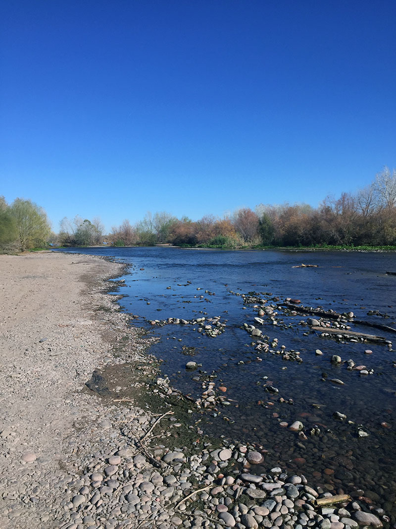
GILA RIVER - Gary Foster Photograph |
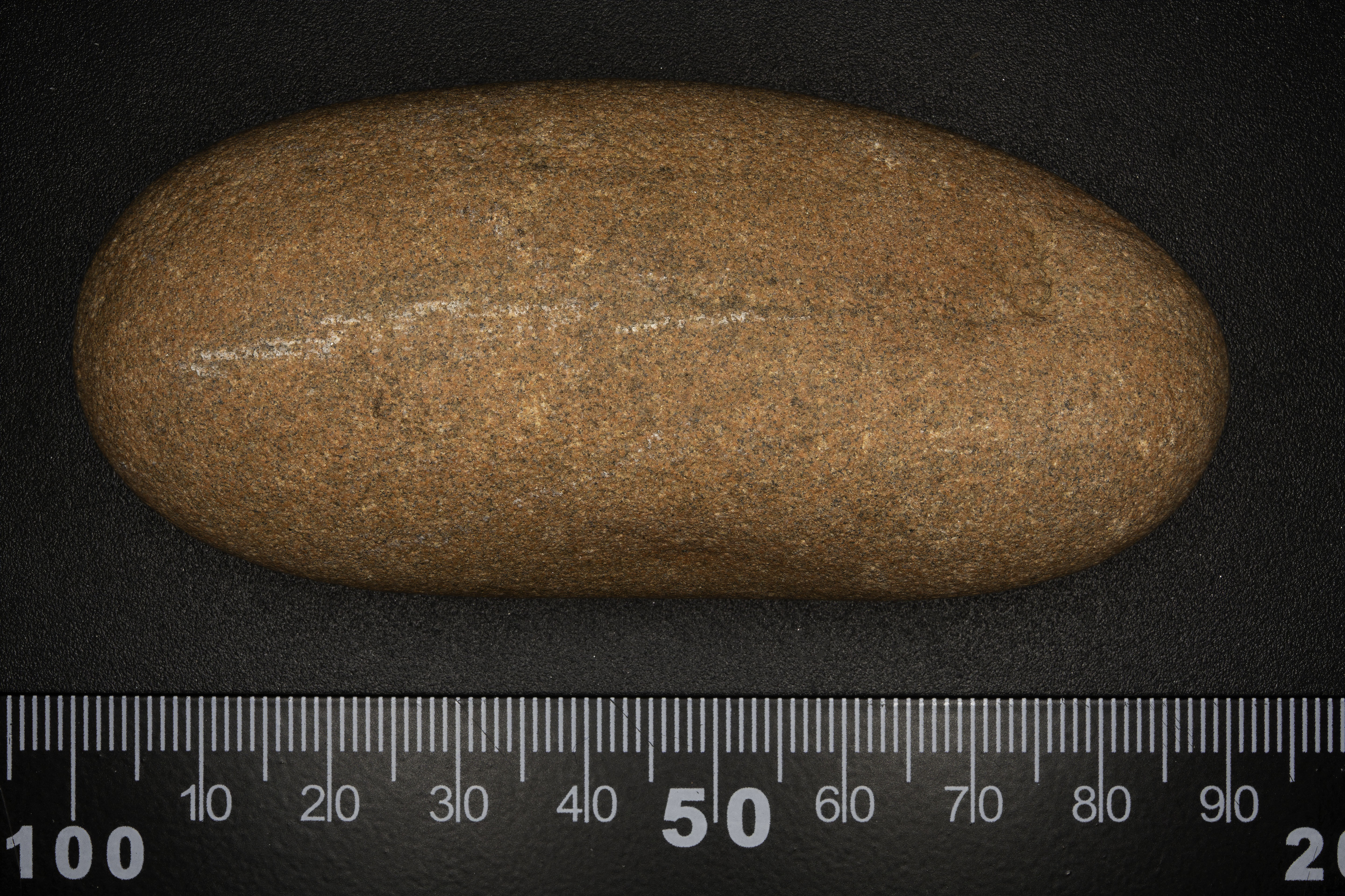
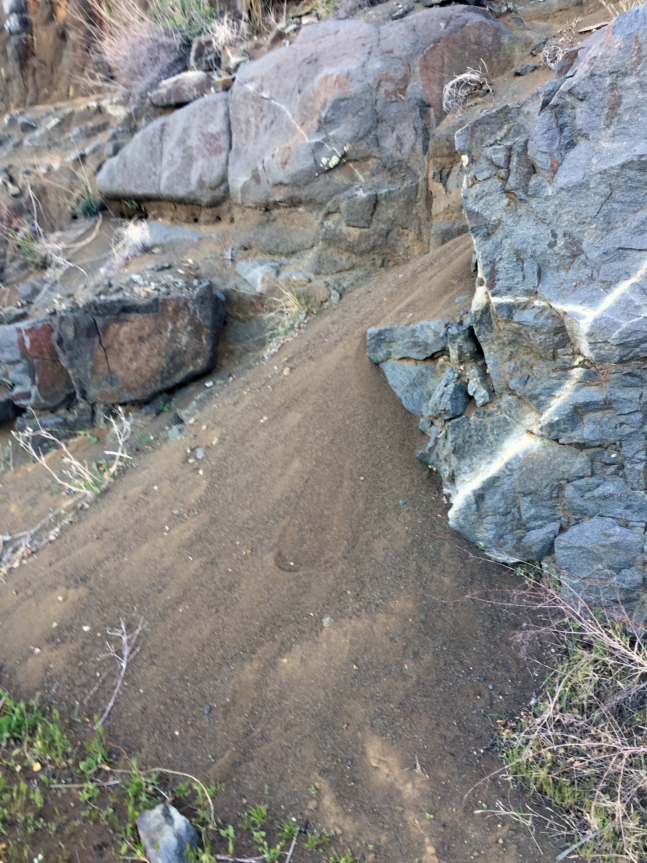
The Salt and Gila rivers are Phoenix’s main source of water. The Salt River is heavily managed by SRP all the way from its source to the end. Northeast of Phoenix, or perhaps due east, north of Mesa, the Salt River looks like a true river with cool, fast flowing water. But as it gets closer to Phoenix, the water is siphoned off for use by consumers and agriculture and by the time the river cuts through the city, it’s a dry riverbed. Just prior to the confluence with the Gila River, the riverbed looks just like the surrounding flat desert. You can’t tell the difference if you didn’t know what to look for. You can drive across the riverbed without even noticing it’s really a river. It’s just desert. The first giveaway are the round rocks that can be caused only by river water tumbling them for millions of years (sample rock from Gila River included). After the confluence, the river flows again because the Gila River is not as controlled and water flows freely. The water you see in the Gila River, post-confluence, is really from the Gila River, not the Salt River. It’s fascinating to learn about and study. Without the two rivers, Phoenix would not exist. There are other water sources of course but these are the main sources. Very important for Phoenix. - Gary Foster |
 |
 |
 |
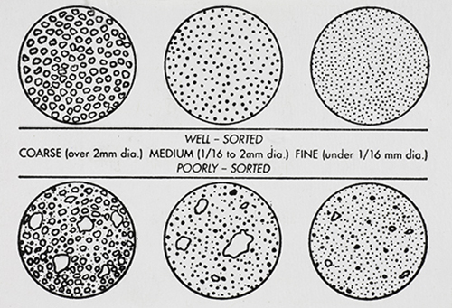
GRAIN DISTRIBUTION CHARACTERISTICS (AGI CHART) |
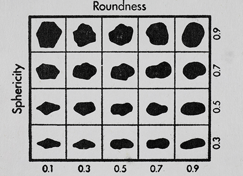
International Space Station 180mm Photograph Image credit: Image Science and Analysis Laboratory, NASA Johnson Space Center | GRAIN SHAPE CHARACTERISTICS(PREPARED BY GAMMA ZETA CHAPTER , SIGMA GAMMA EPSILON, KENT STATE UNIVERSITY - AGI CHART))Roundness is the degree of smoothing due to abrasion of sedimentary particles. It is expressed as the ratio of the average radius of curvature of the edges or corners to the radius of curvature of the maximum inscribed sphere.The sphericity of a particle is: the ratio of the surface area of a sphere (with the same volume as the given particle) to the surface area of the particle. |
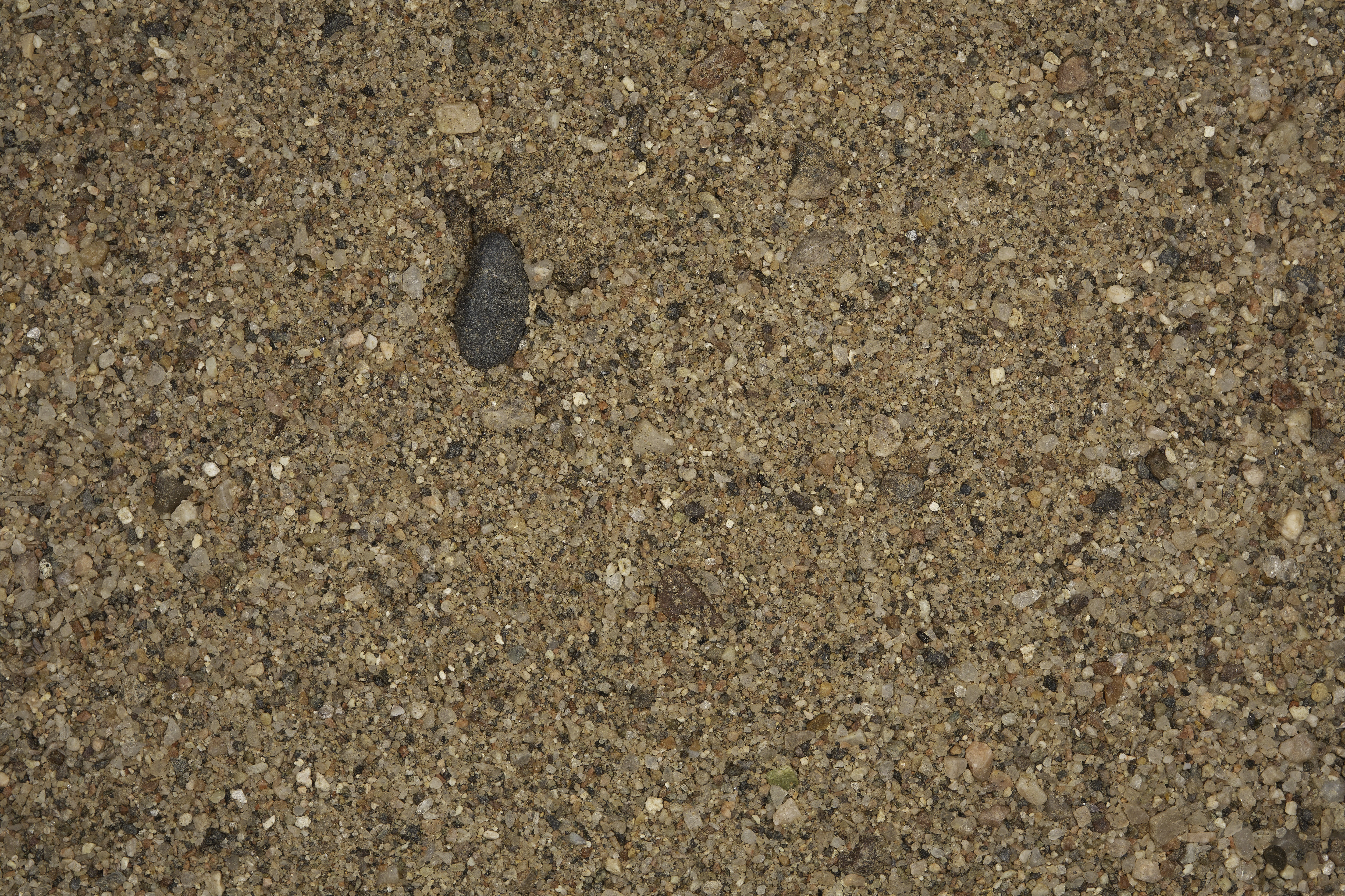
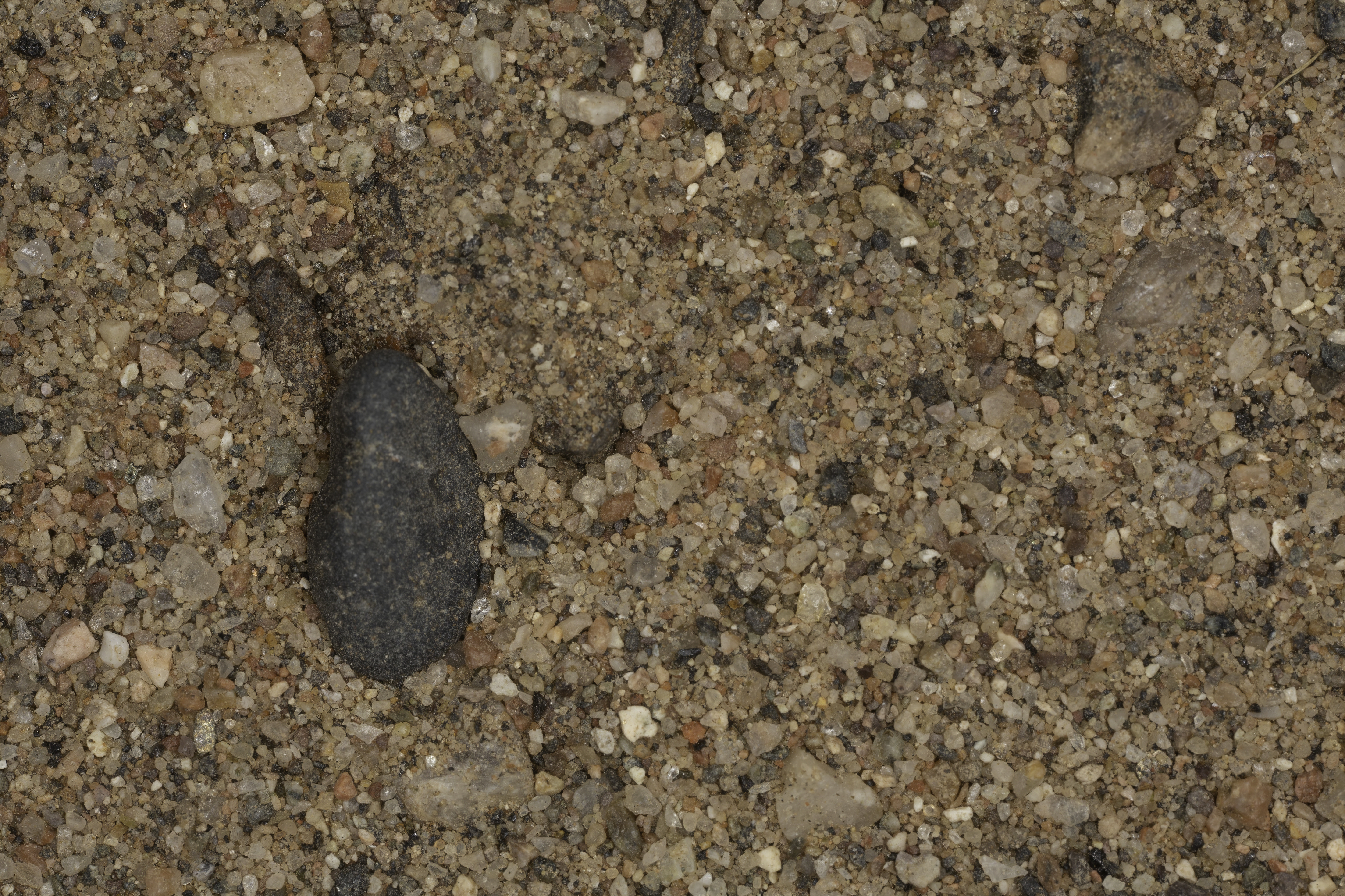
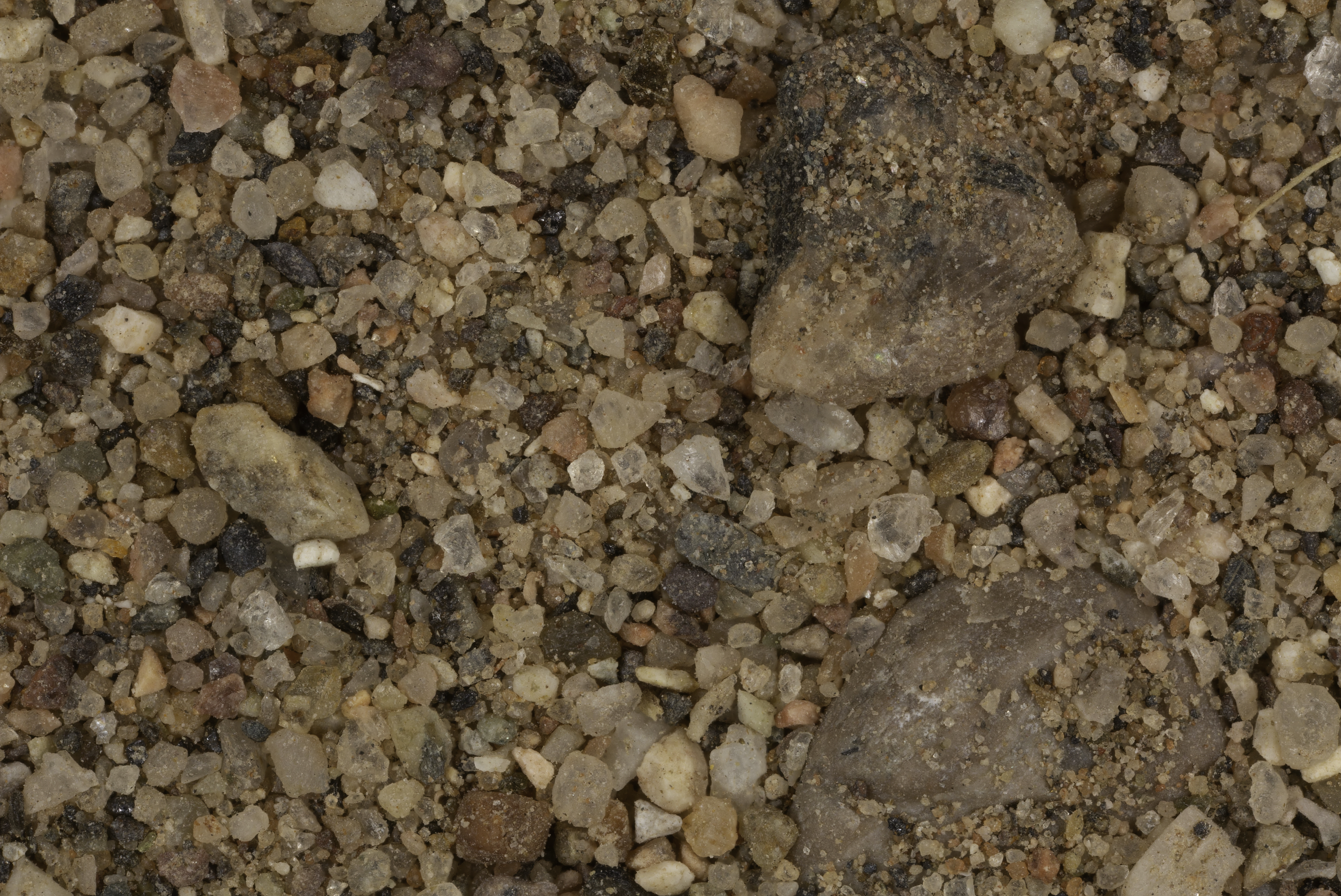
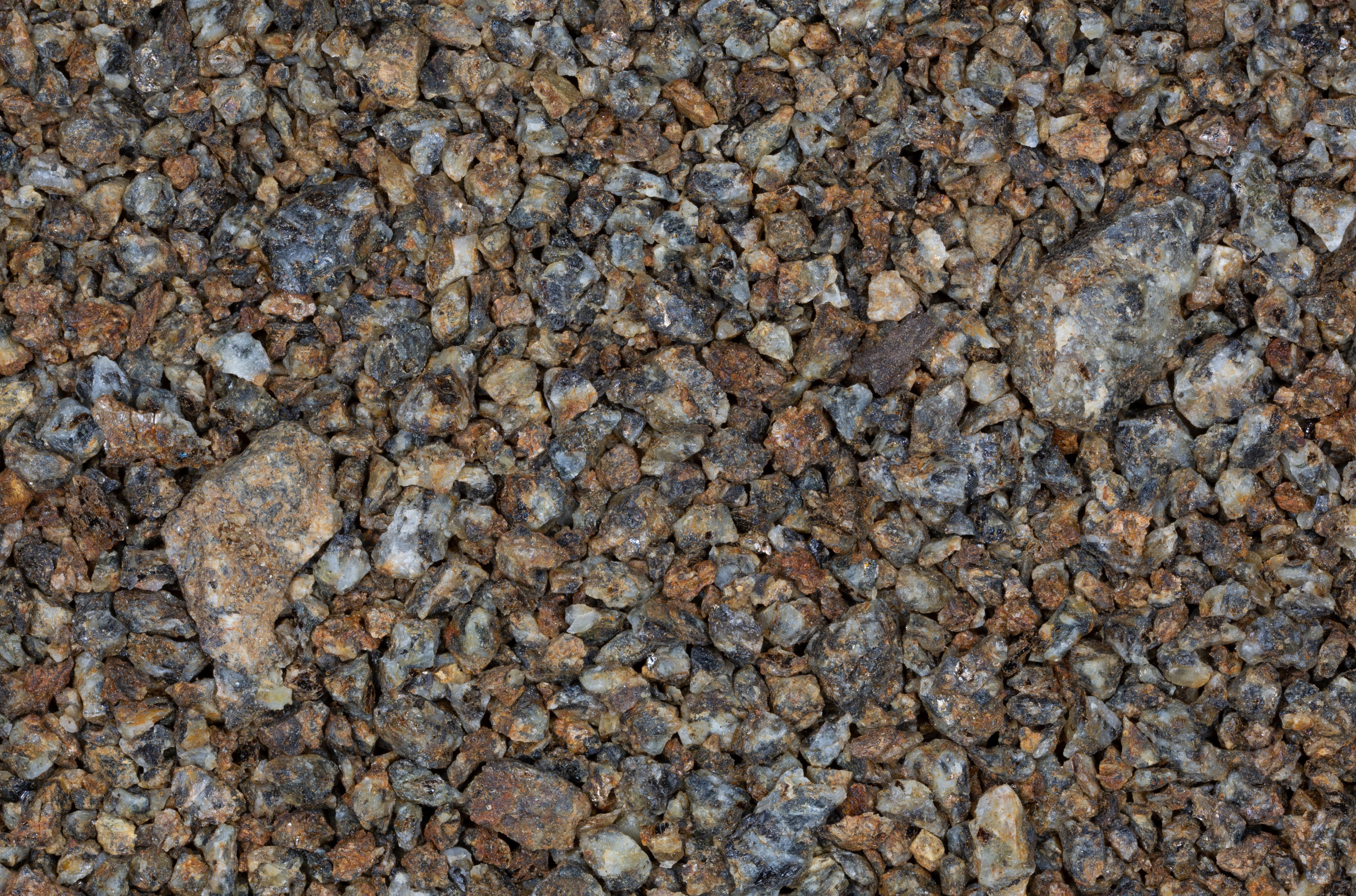
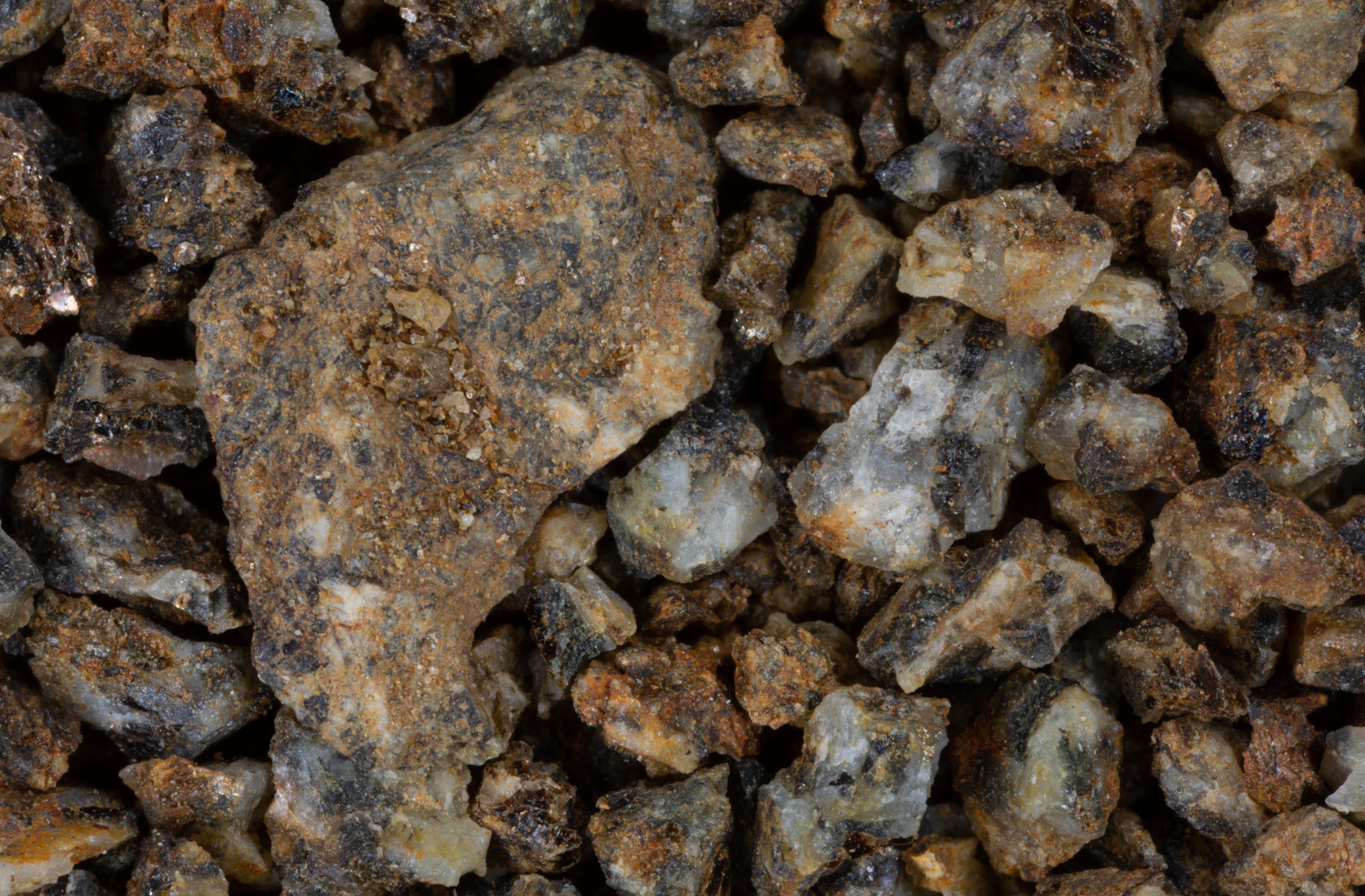
GILA RIVER |
||
 |
 |
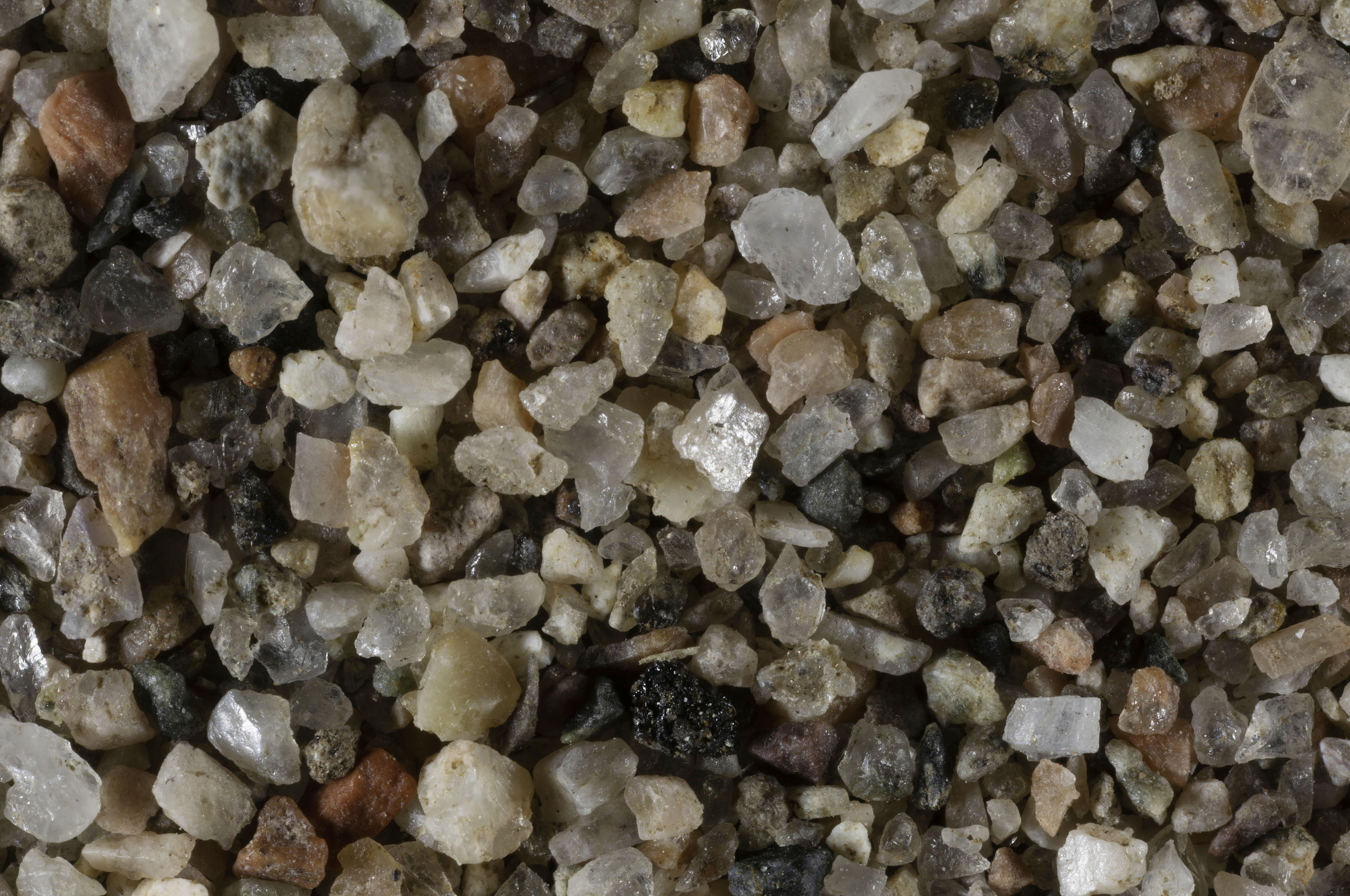 |
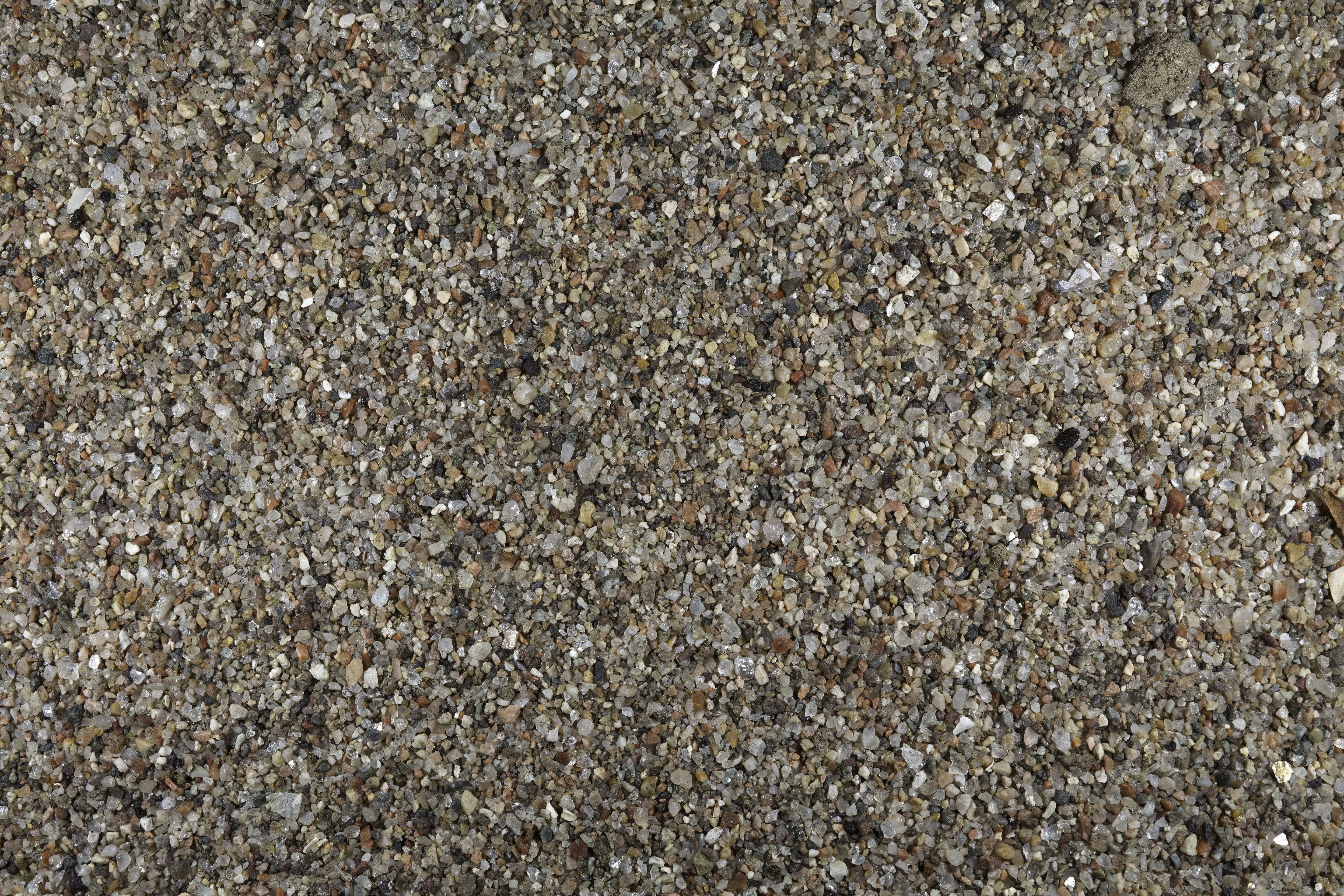
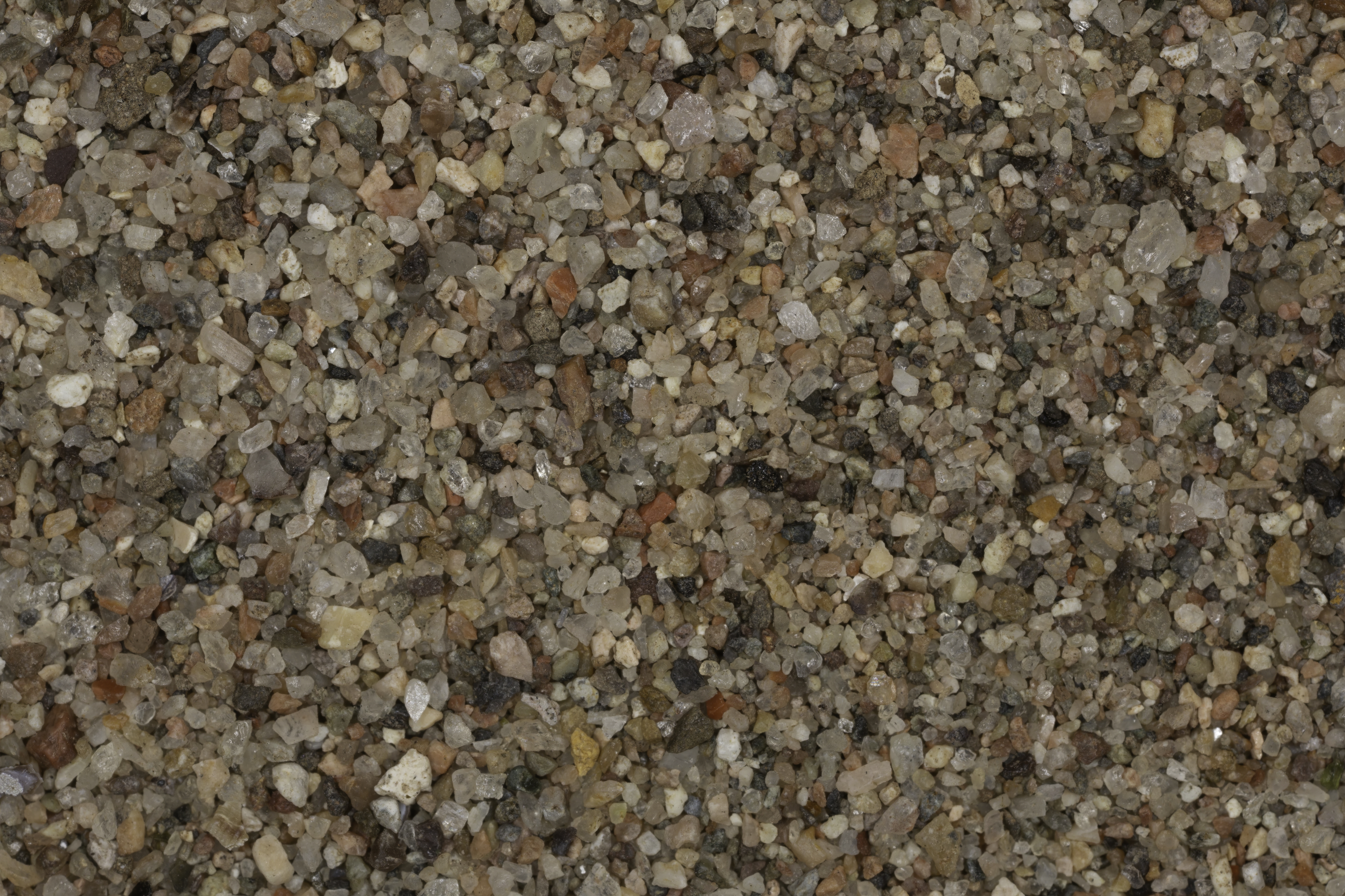
0X IMAGE |
1X IMAGE |
3X IMAGE |
| Click on Image for High Resolution Version | Click on Image for High Resolution Version | Click on Image for High Resolution Version |
GILA RIVER ROCK |
||
 |
||
RIVER ROCK |
||
| Click on Image for High Resolution Version | ||
SALT RIVER |
||
 |
 |
 |
0X IMAGE (BACKGROUND IMAGE) |
1X IMAGE |
3X IMAGE |
SAMPLE #2 |
 |
SALT RIVER COLLECTION SITE - Gary Foster Photograph |
| Click on Image for High Resolution Version |
 |
|
 |
0X IMAGE |
1X IMAGE |
3X IMAGE |
| Click on Image for High Resolution Version | Click on Image for High Resolution Version | Click on Image for High Resolution Version |
SALT RIVER ROCK SAMPLE |
||
 |
||
| Click on Image for High Resolution Version |
RETURN TO HOME |
RETURN TO ARIZONA |