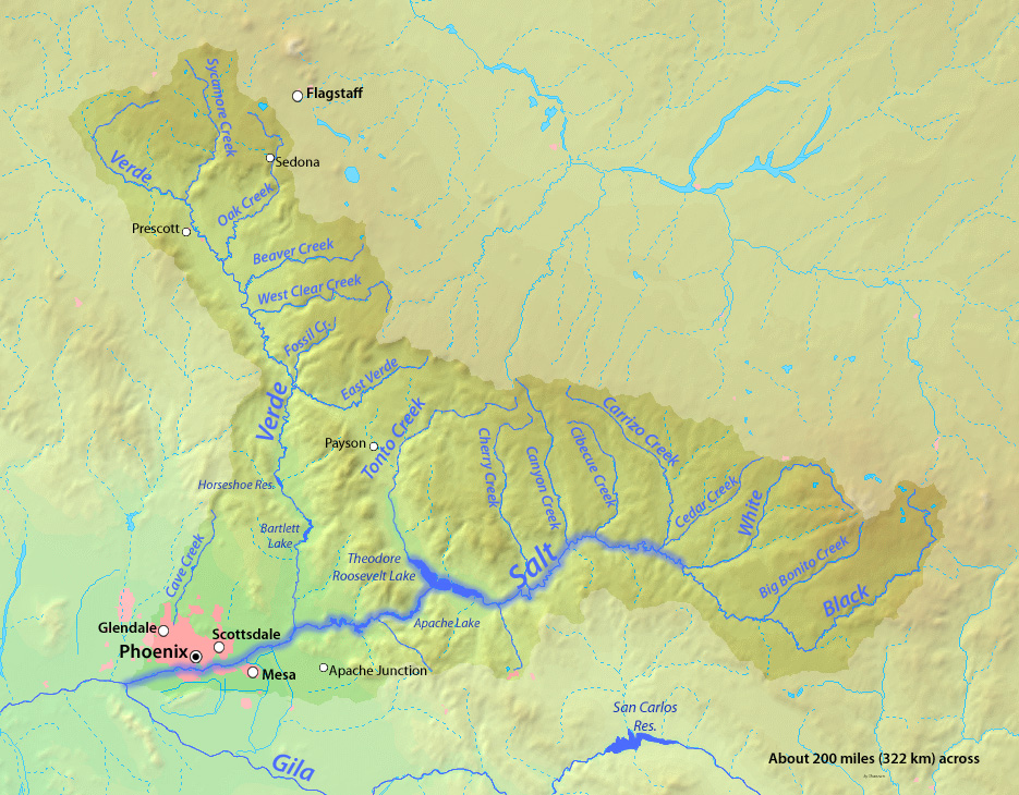
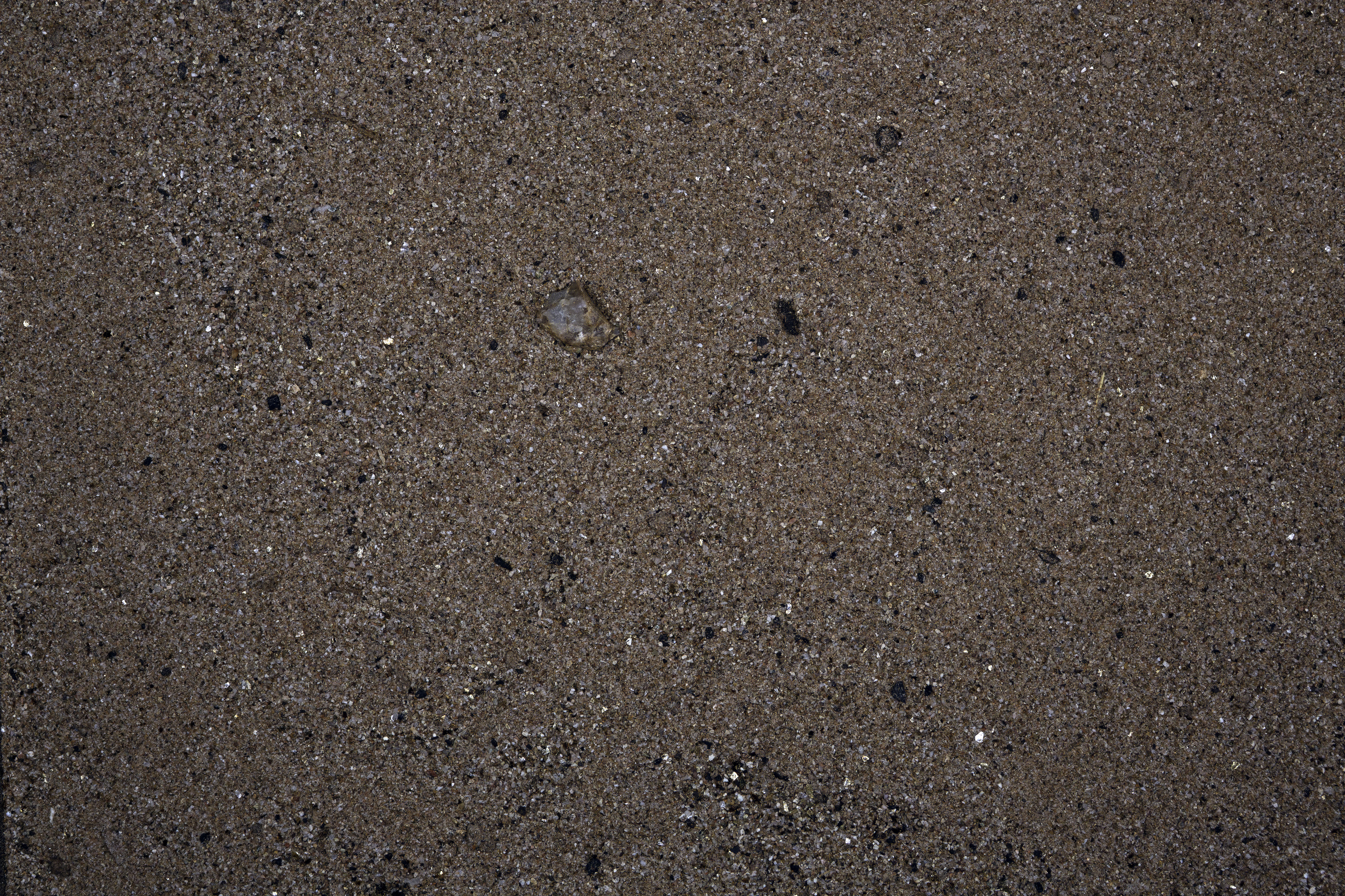
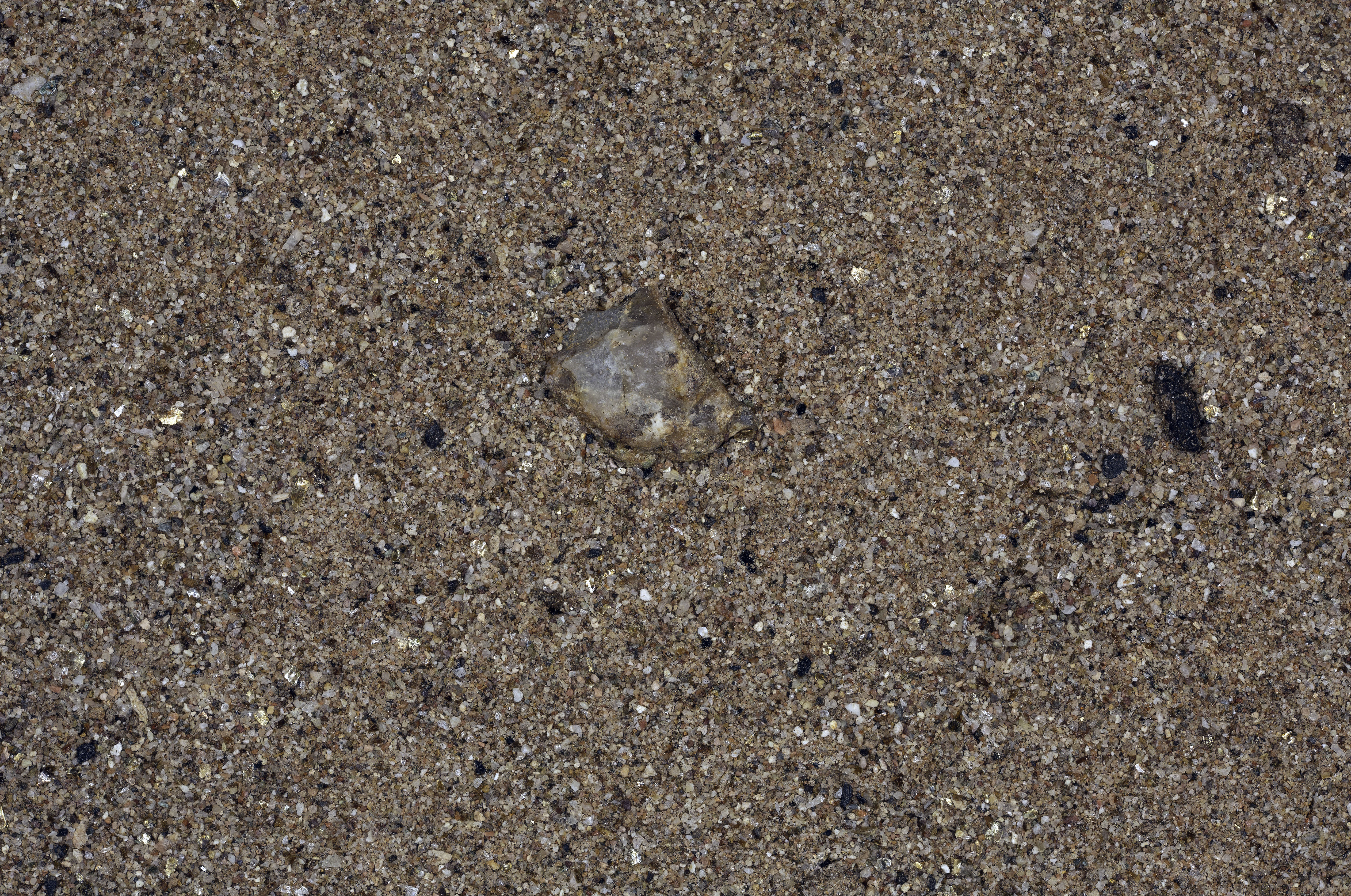
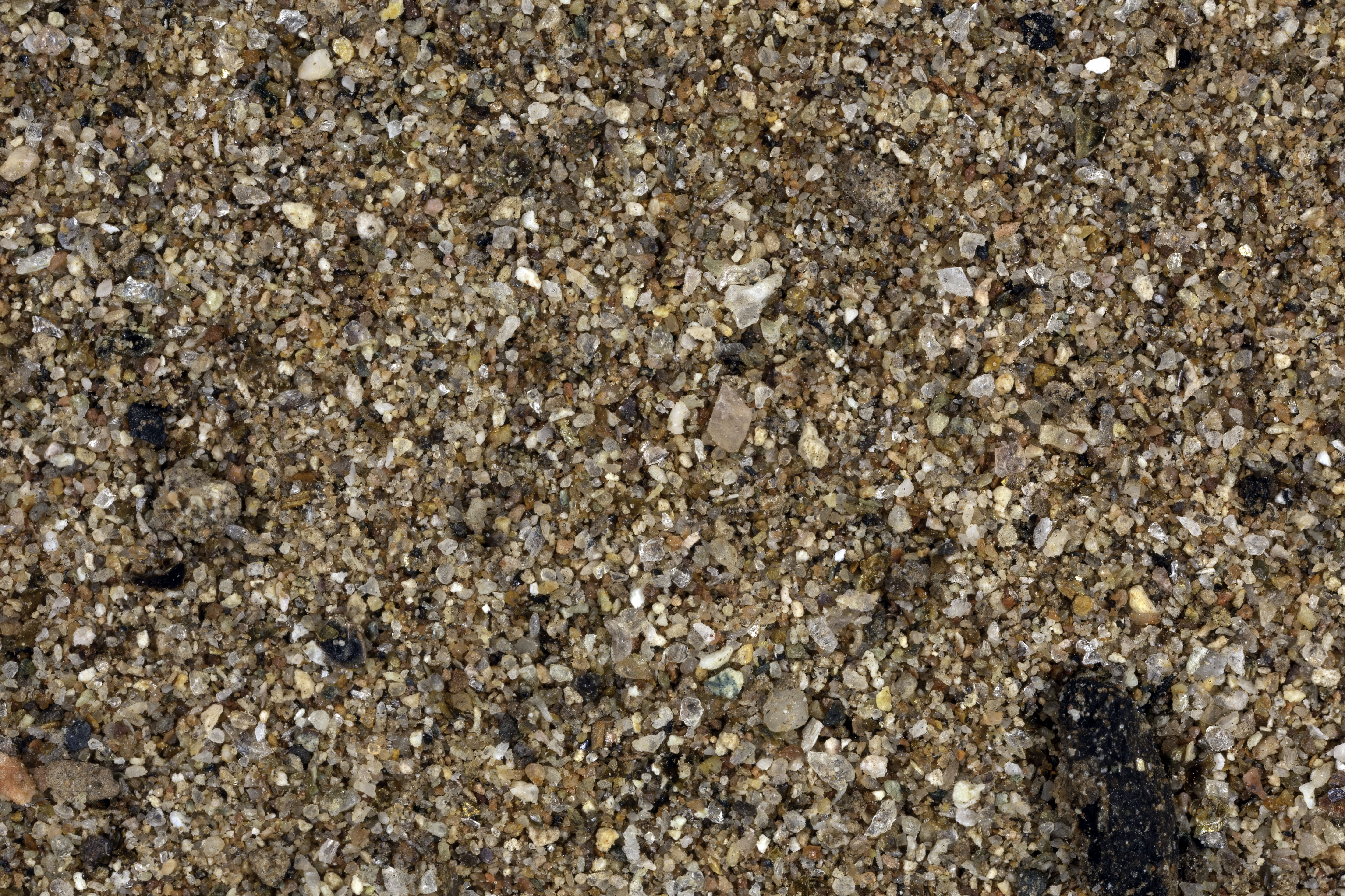
LOWER SALT RIVER NEAR RED MOUNTAIN, MESA, ARIZONA |
|
LOWER SALT RIVER - Wikipedia Map |
"The sample was collected from the lower Salt River near Red Mountain at the end of Coons Bluff Road off Power Road, just northeast of Mesa, Arizona. The Salt River is controlled and feeds the irrigation canals. At times the river is completely dry, and at other times it rages depending on the control. Without the river, there would be little agriculture in the Phoenix Valley." Gary Foster |
 |
 |
 |
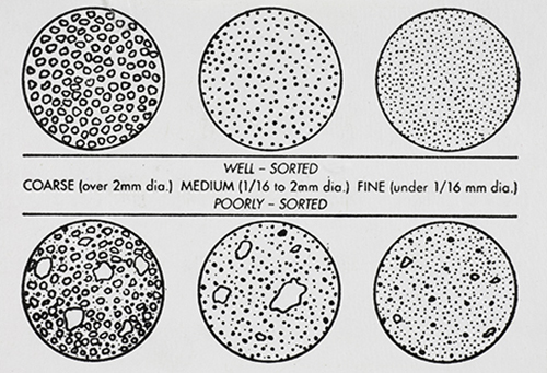
GRAIN DISTRIBUTION CHARACTERISTICS (AGI CHART) |
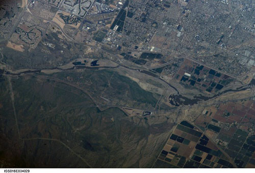
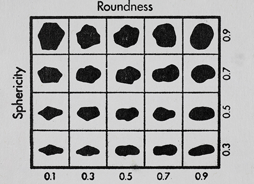
International Space Station 800mm Photograph Image credit: Image Science and Analysis Laboratory, NASA Johnson Space Center | GRAIN SHAPE CHARACTERISTICS(PREPARED BY GAMMA ZETA CHAPTER , SIGMA GAMMA EPSILON, KENT STATE UNIVERSITY - AGI CHART))Roundness is the degree of smoothing due to abrasion of sedimentary particles. It is expressed as the ratio of the average radius of curvature of the edges or corners to the radius of curvature of the maximum inscribed sphere.The sphericity of a particle is: the ratio of the surface area of a sphere (with the same volume as the given particle) to the surface area of the particle. |
 |
 |
 |
0X IMAGE (BACKGROUND IMAGE) |
1X IMAGE |
3X IMAGE |
| Click on Image for High Resolution Version | Click on Image for High Resolution Version | Click on Image for High Resolution Version |
RETURN TO HOME |
RETURN TO ARIZONA |
#/media/File:Salt_River_Map.jpg)