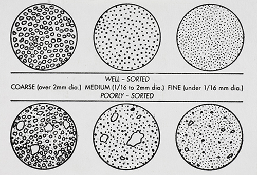
GRAIN DISTRIBUTION CHARACTERISTICS (AGI CHART) |
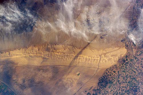
Astronaut photo of the Algodones Dunes, at the borders of California, Arizona, and Mexico. The All-American Canal cuts across the southern end of the dunes and the Cargo Muchacho Mountains can be seen beneath cloud cover at the top of the scene. Remains of the Alamo Canal are located parallel to the left side of the Colorado River (center far right of image), with the intake still visible near Pilot Knob. |
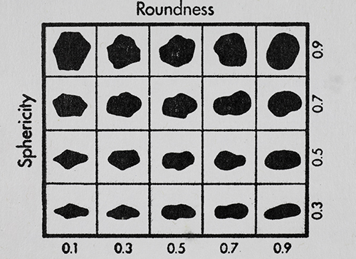
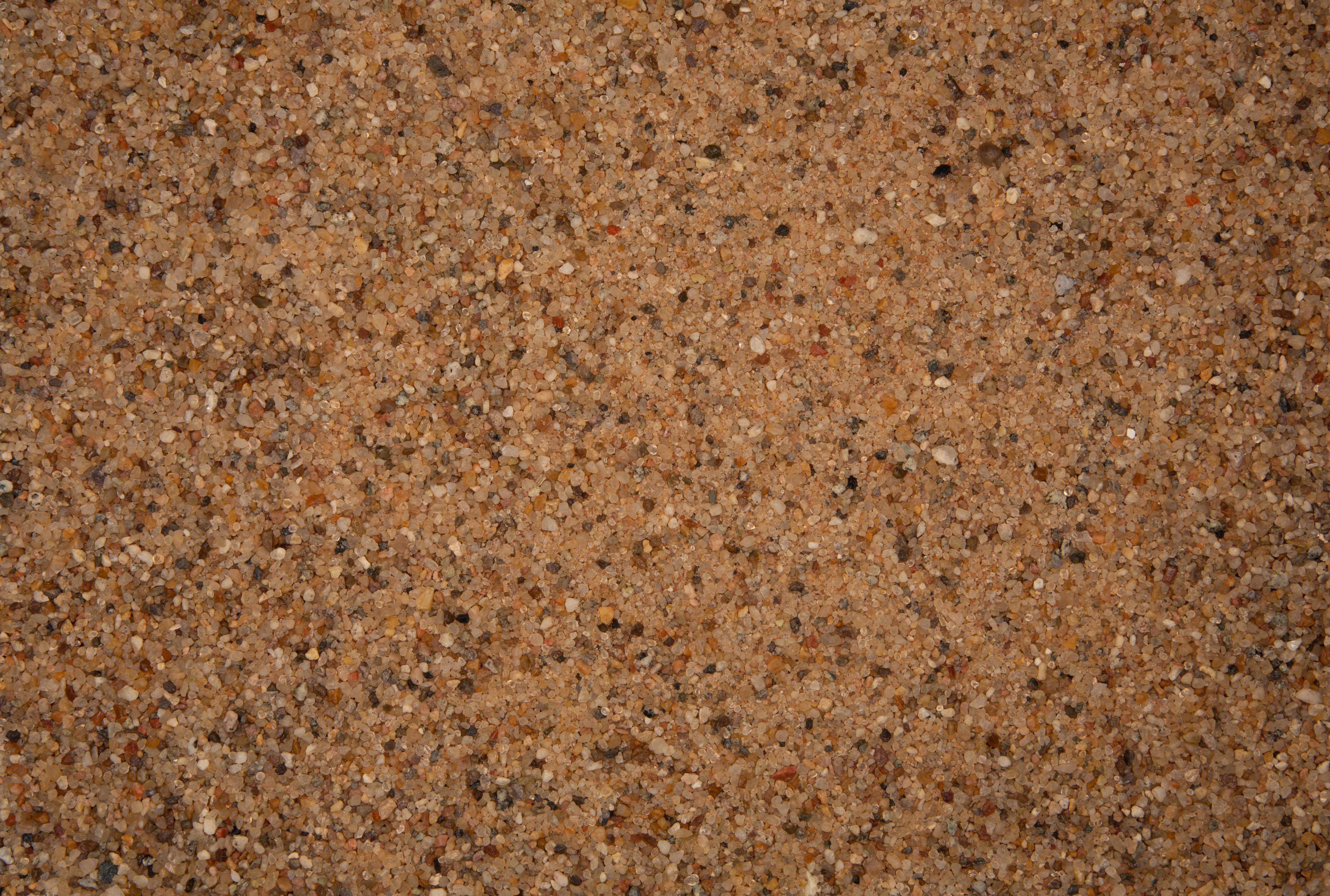
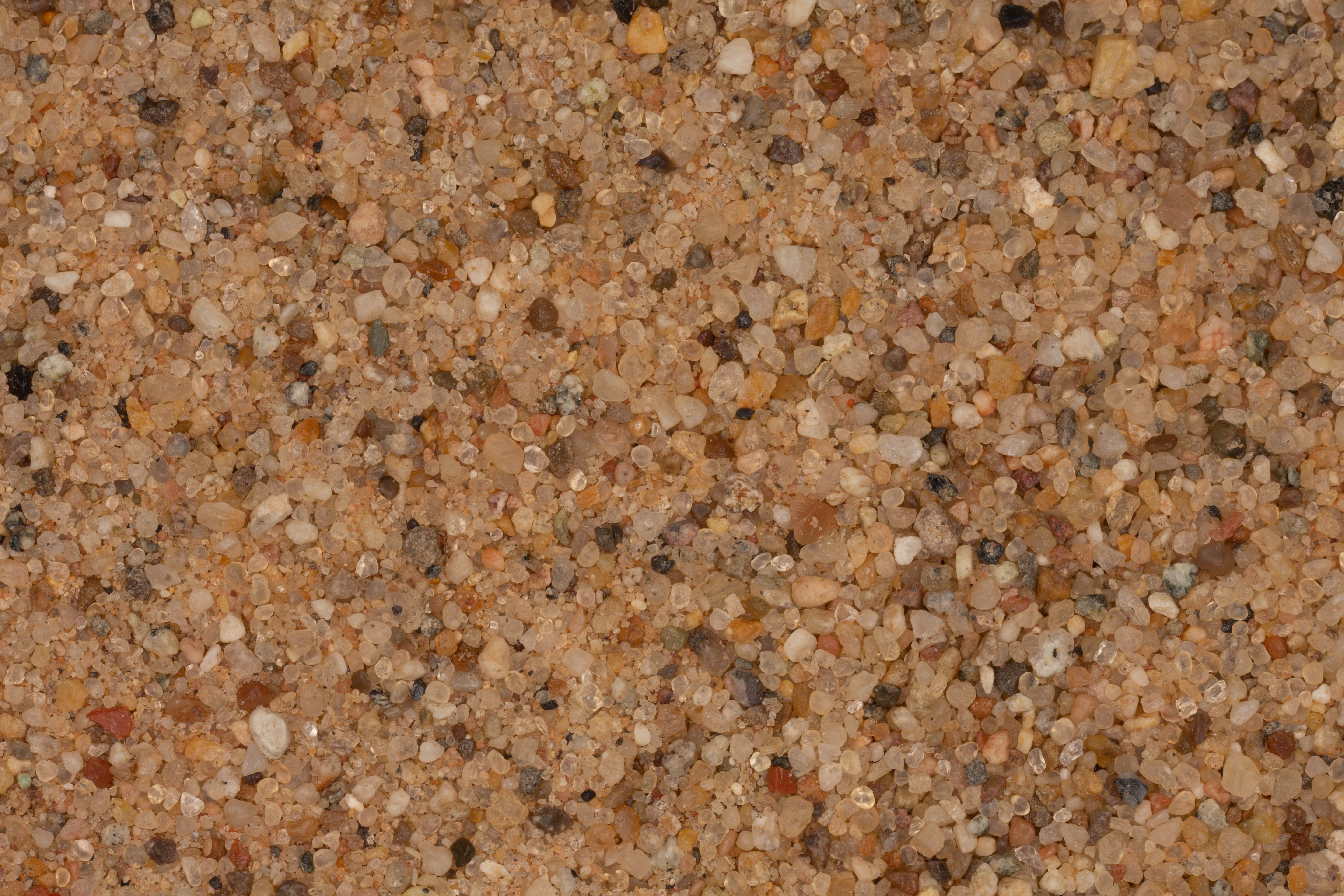
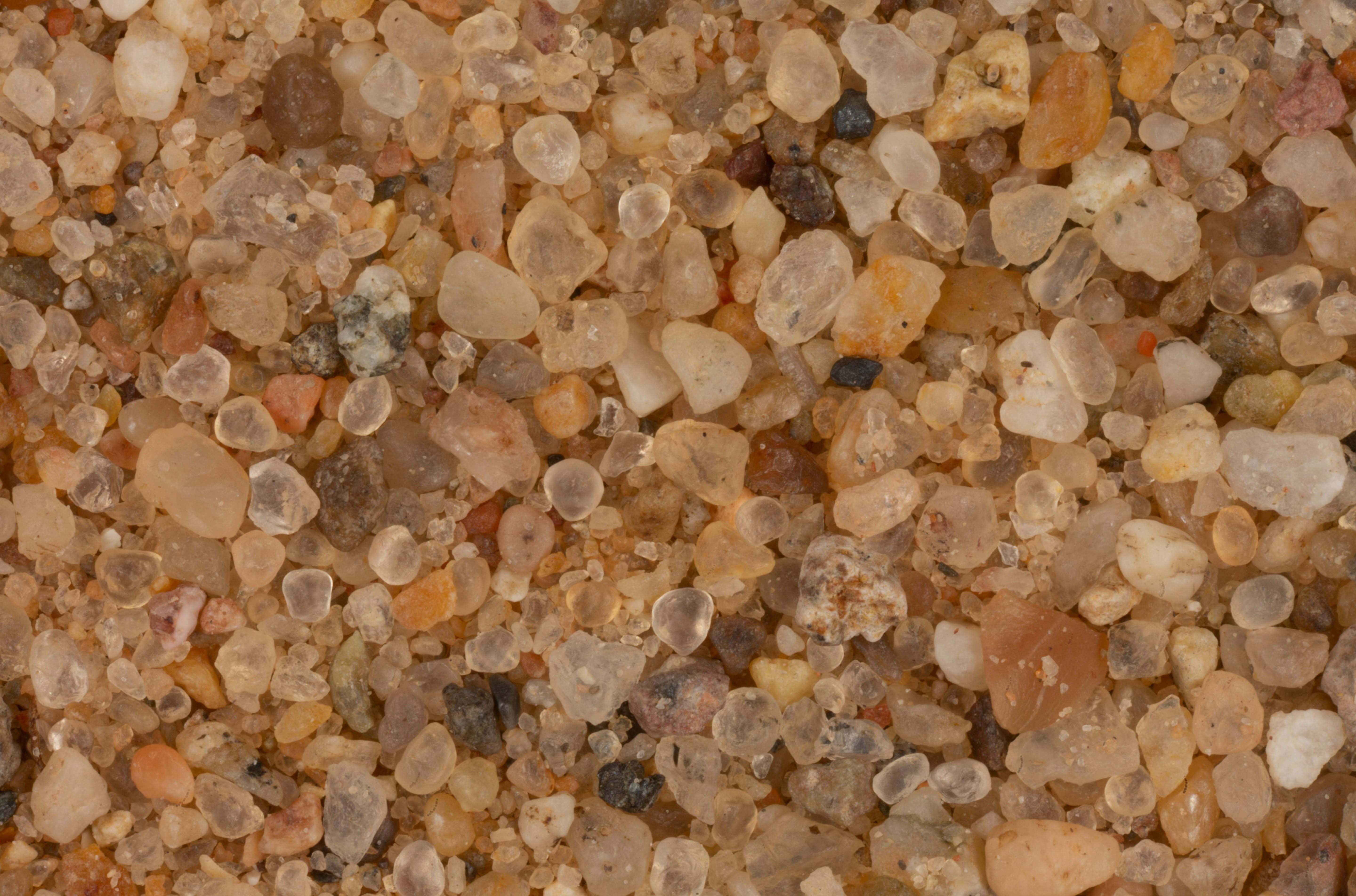
GRAIN SHAPE CHARACTERISTICS
(PREPARED BY GAMMA ZETA CHAPTER , SIGMA GAMMA EPSILON, KENT STATE UNIVERSITY - AGI CHART))
Roundness is the degree of smoothing due to abrasion of sedimentary particles. It is expressed as the ratio of the average radius of curvature of the edges or corners to the radius of curvature of the maximum inscribed sphere.
The sphericity of a particle is: the ratio of the surface area of a sphere (with the same volume as the given particle) to the surface area of the particle. |