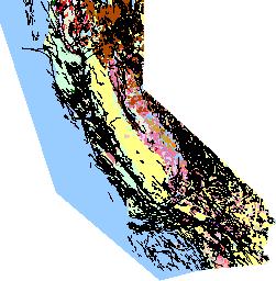
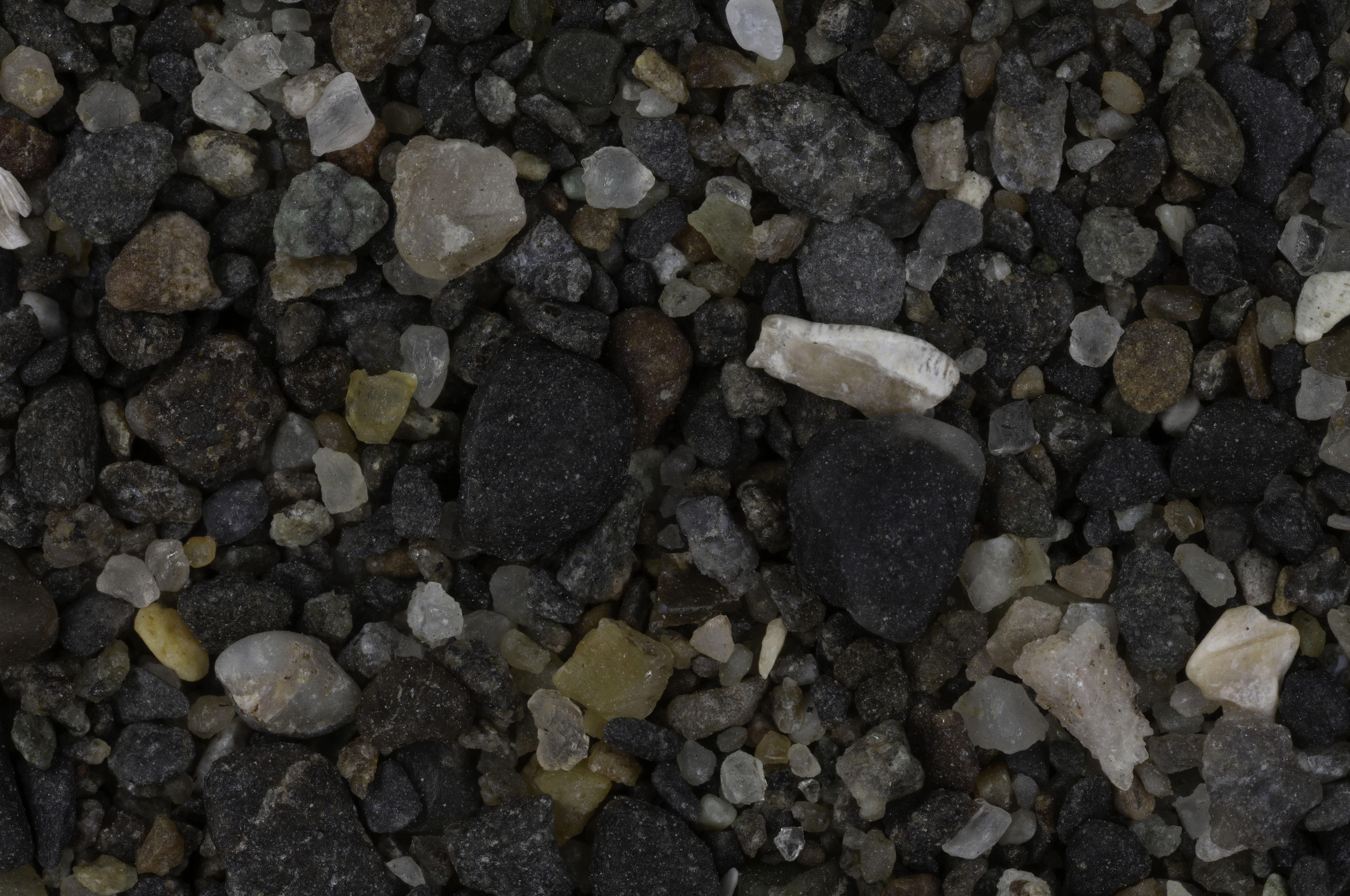
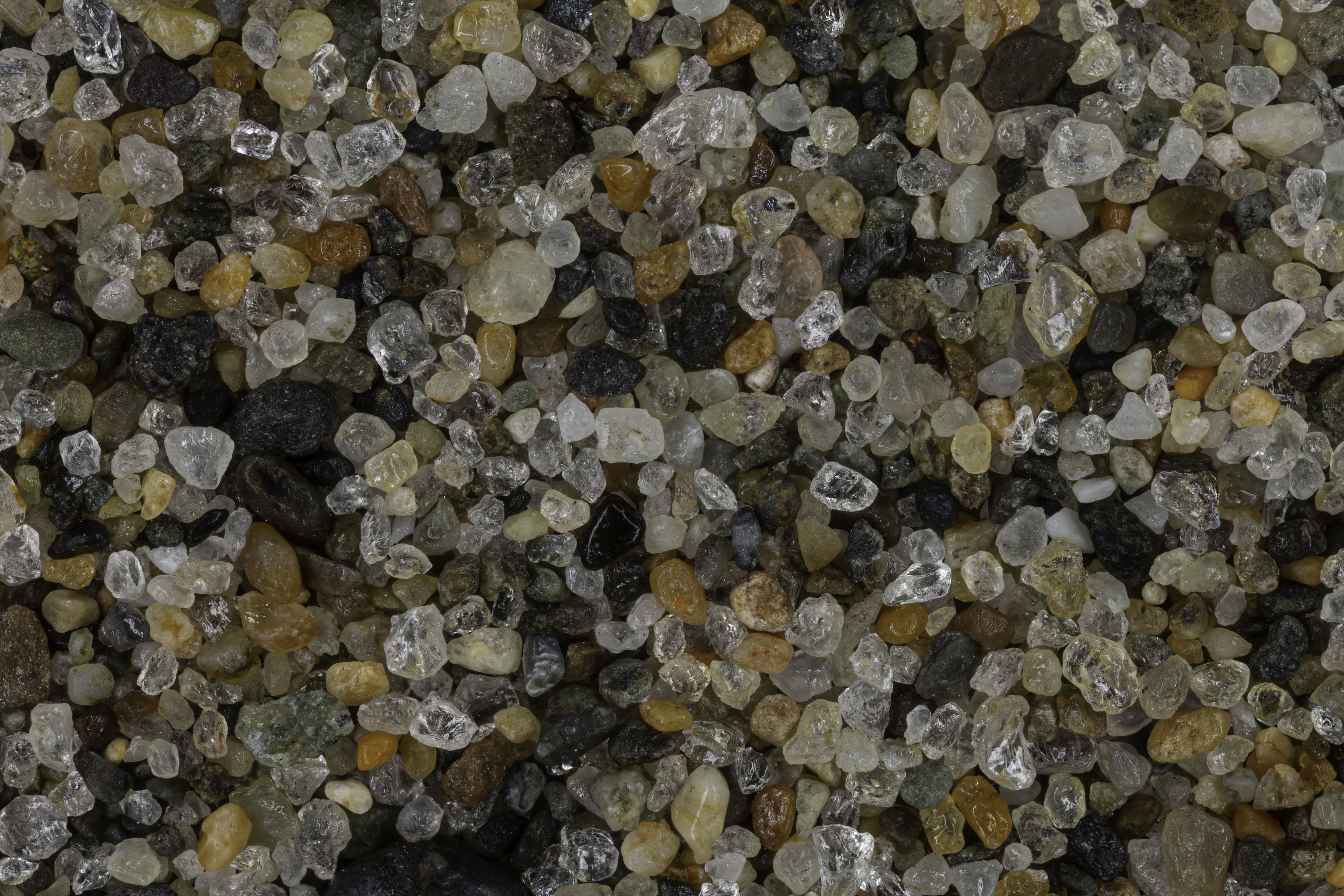
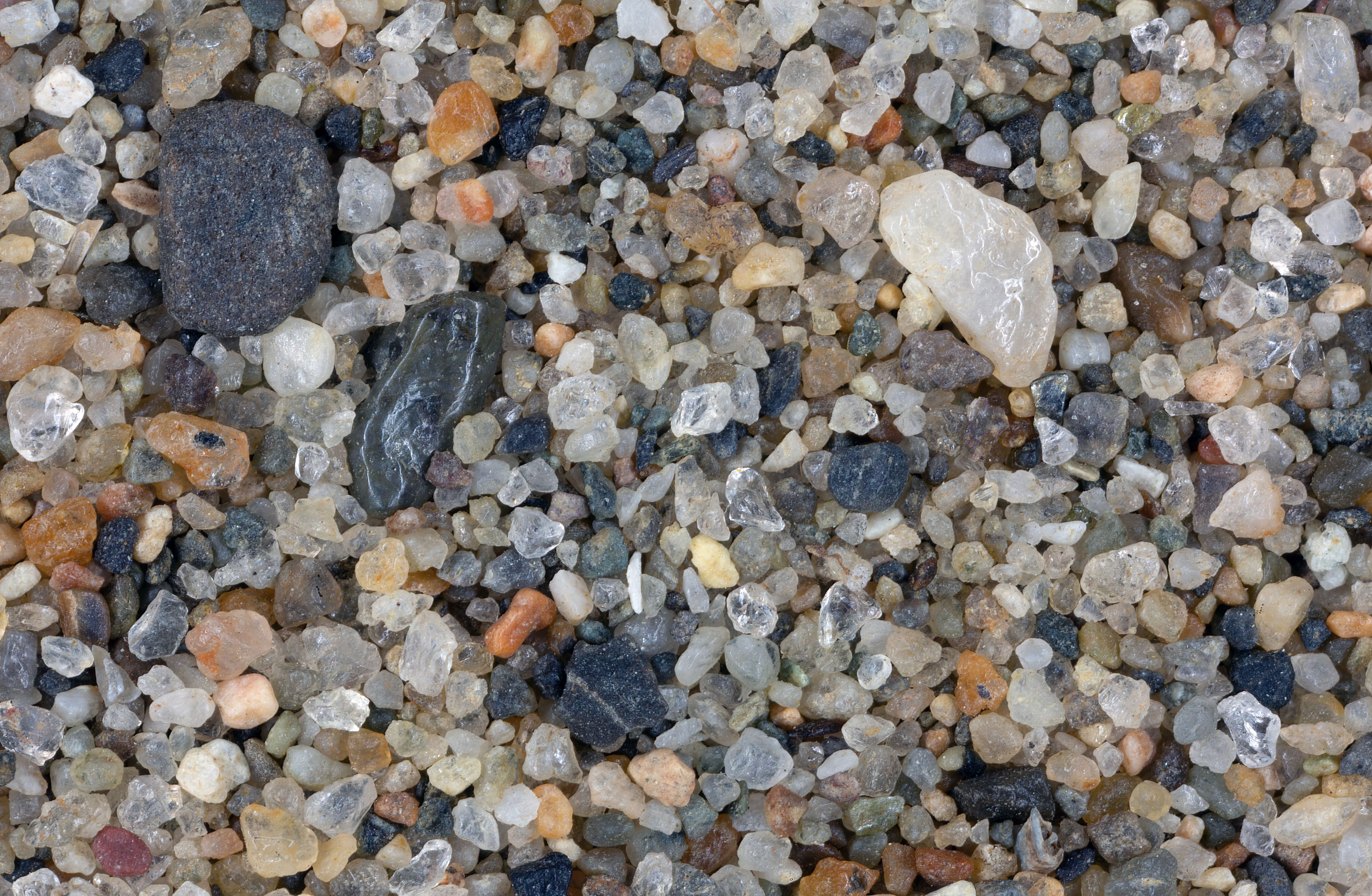
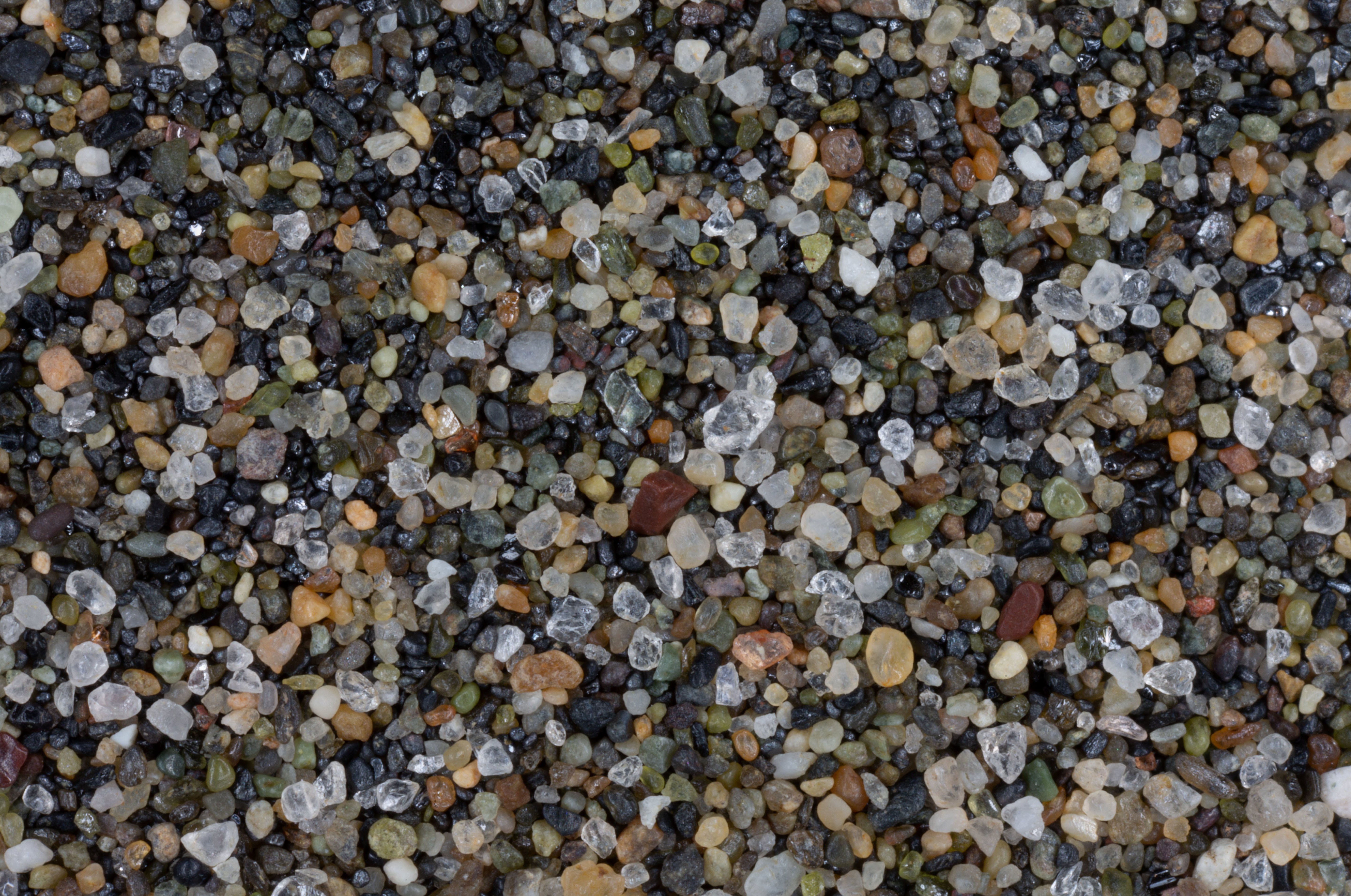
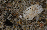
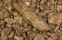
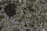
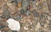
CLICK MAP TO GO TO USGS SITE |
| LOCATION |
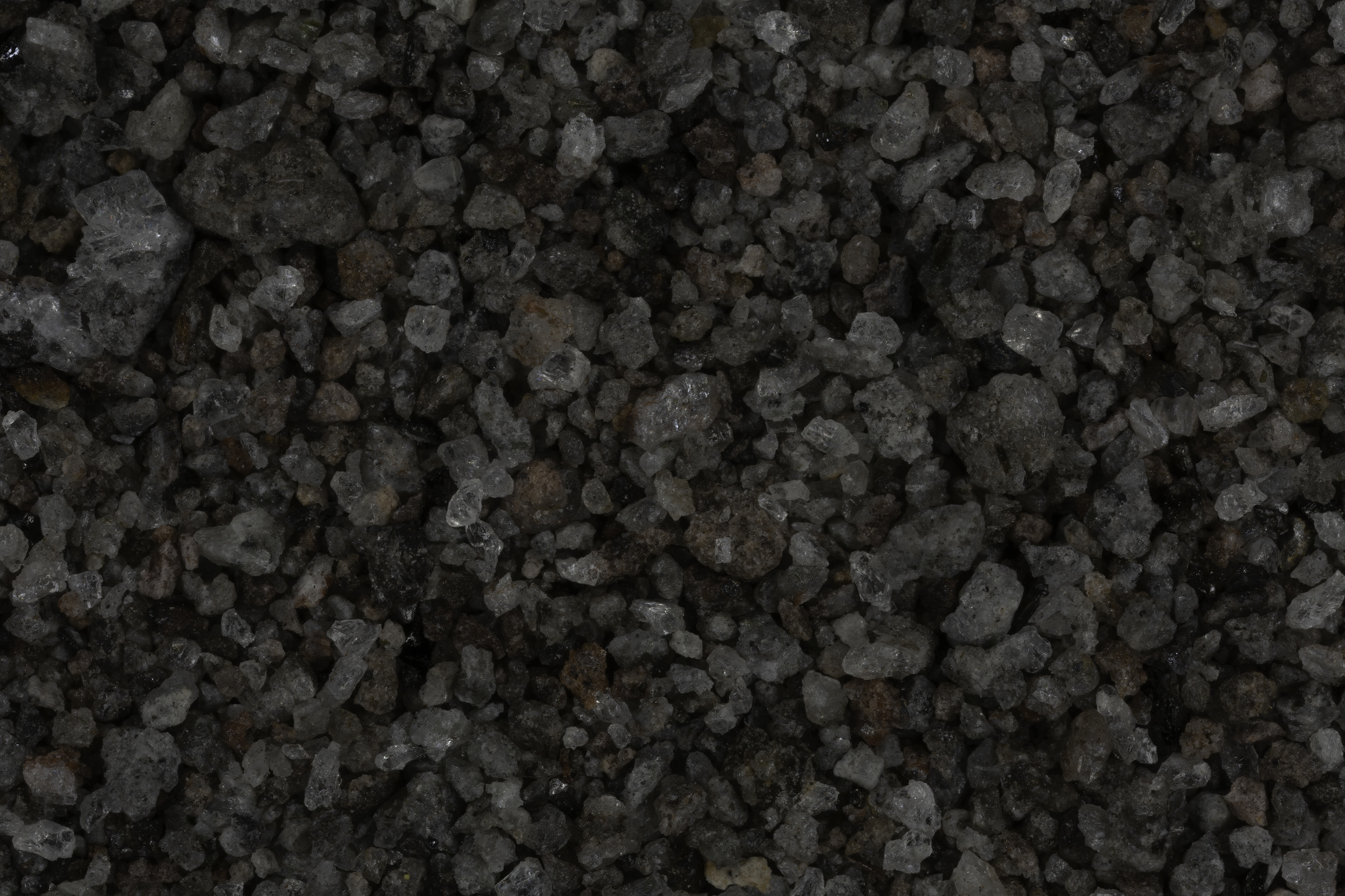
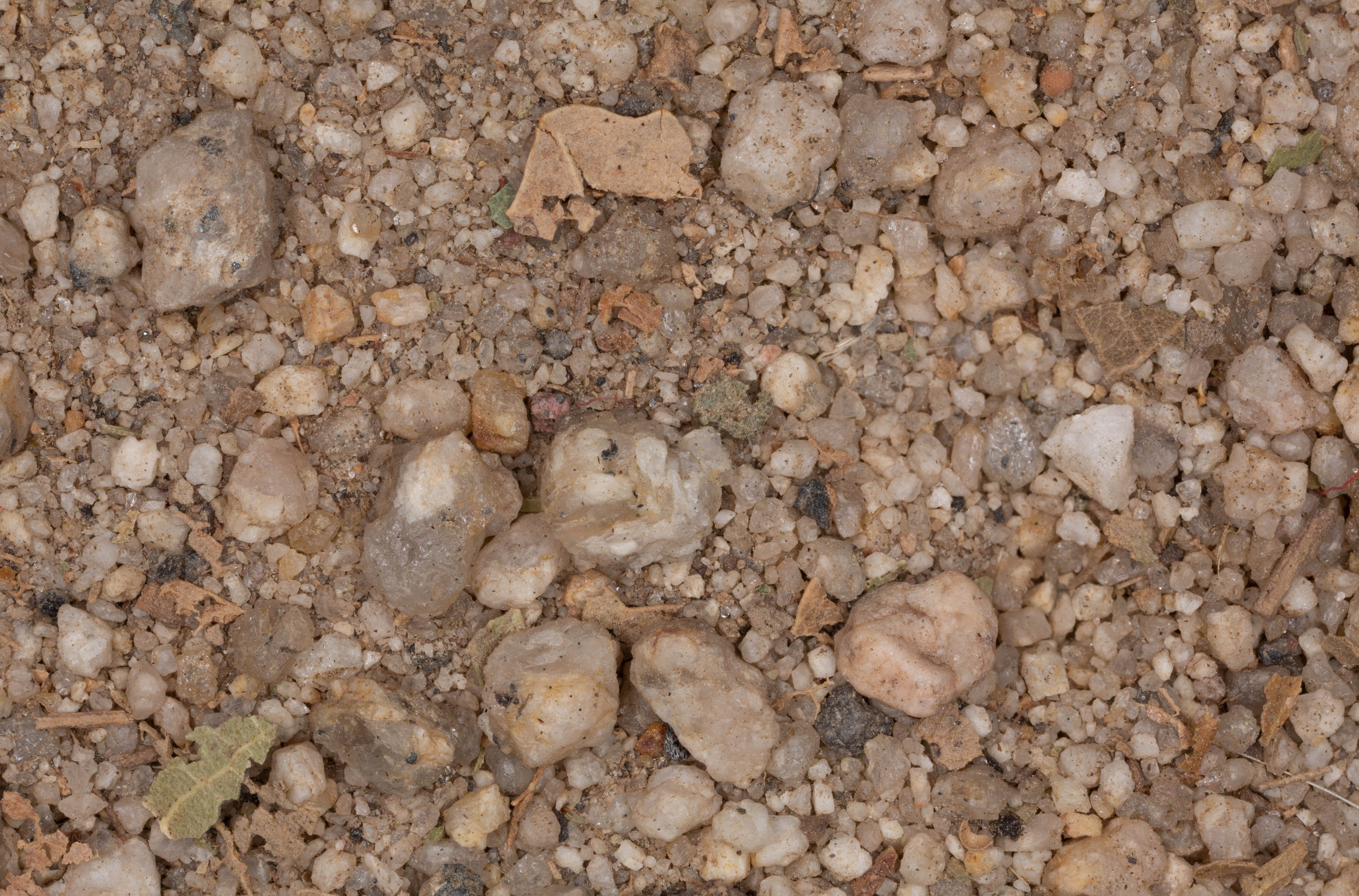
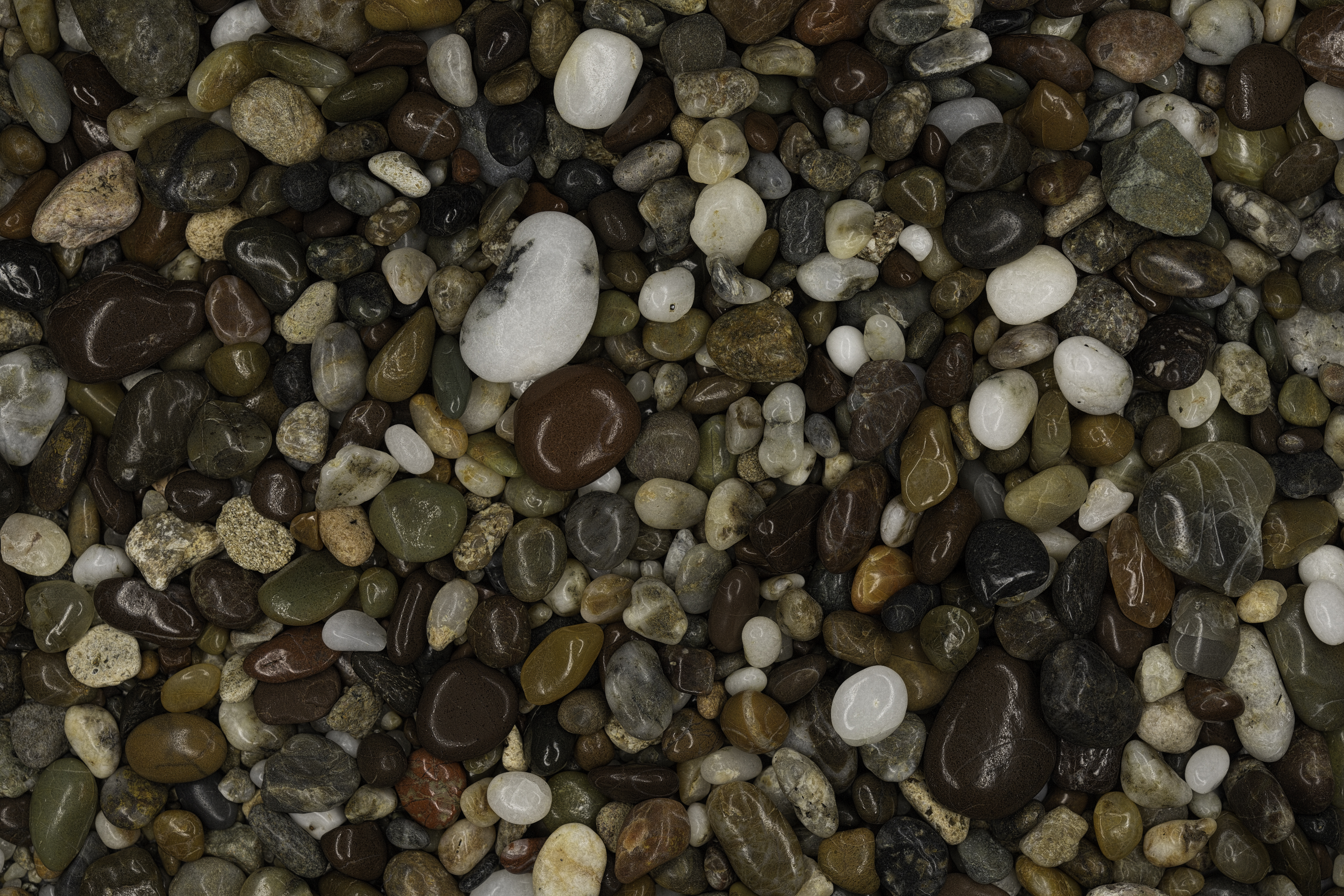
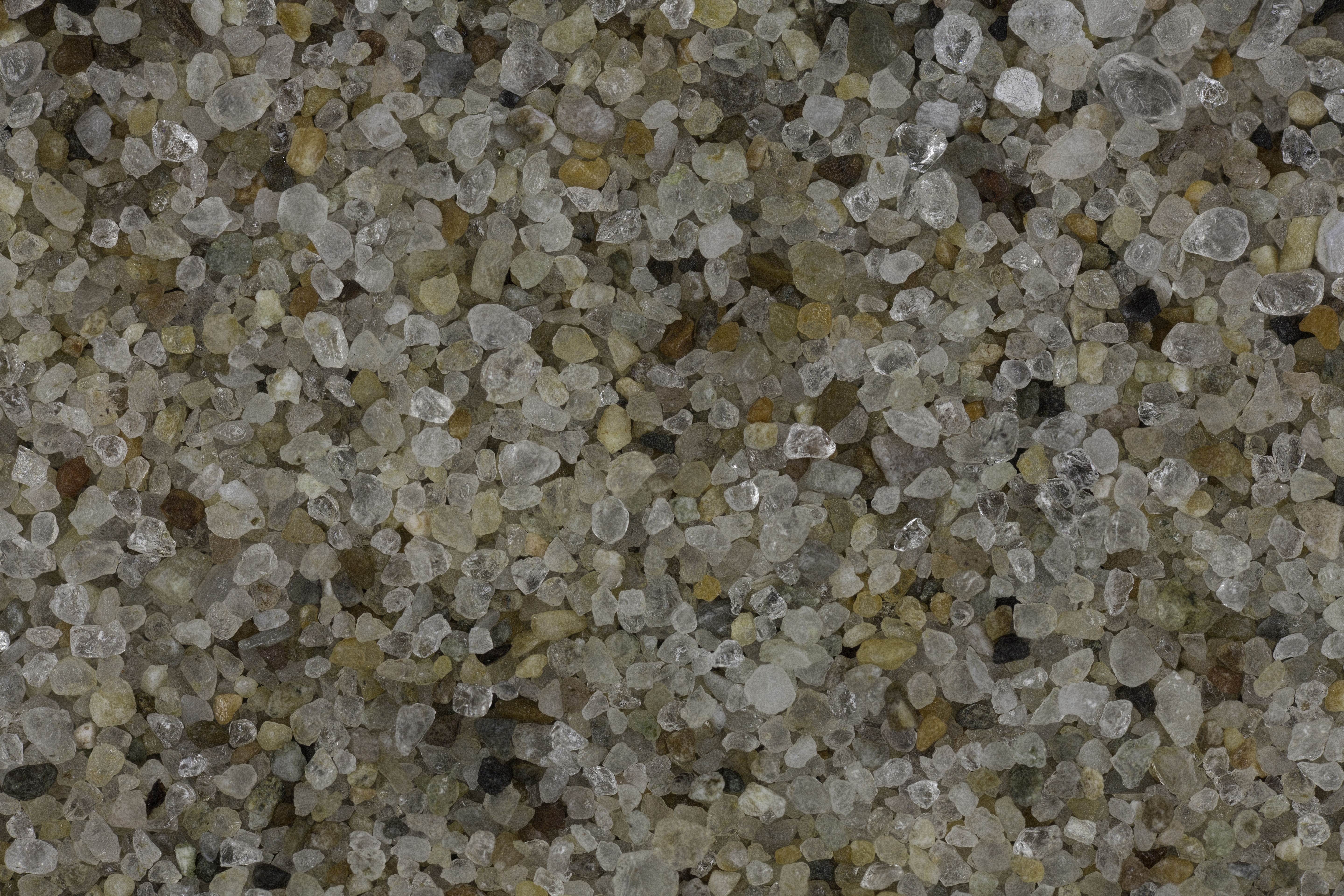
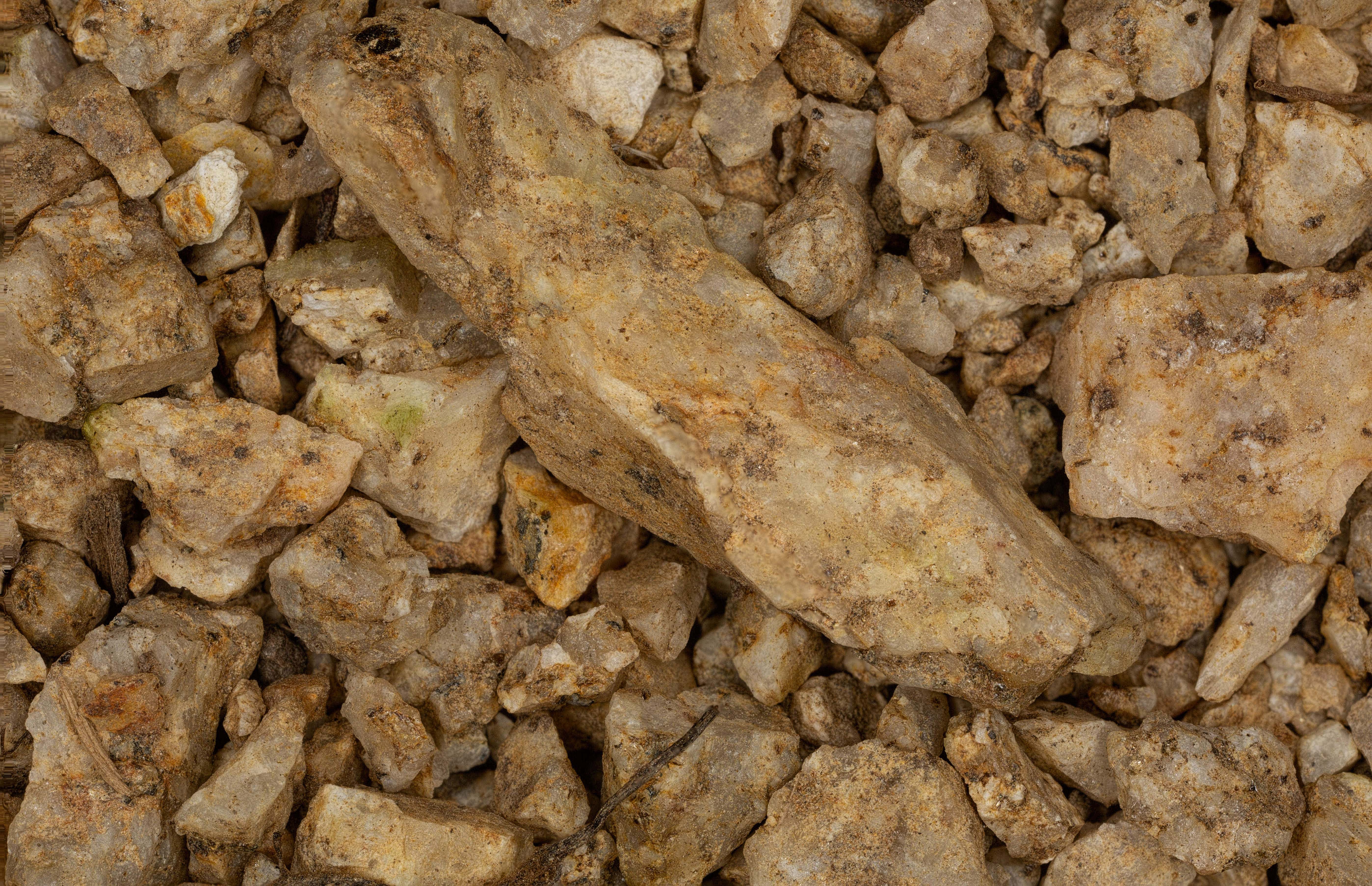
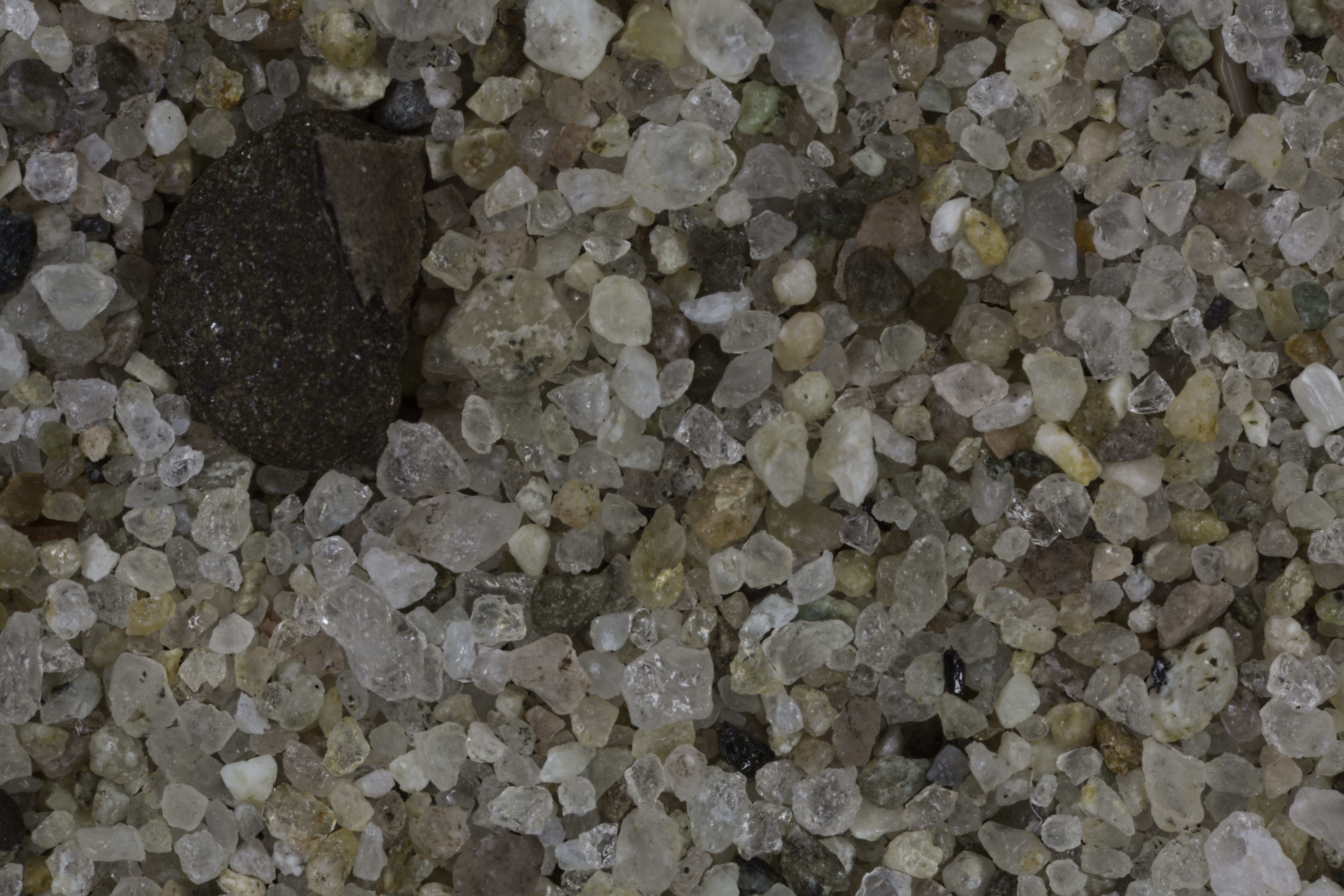
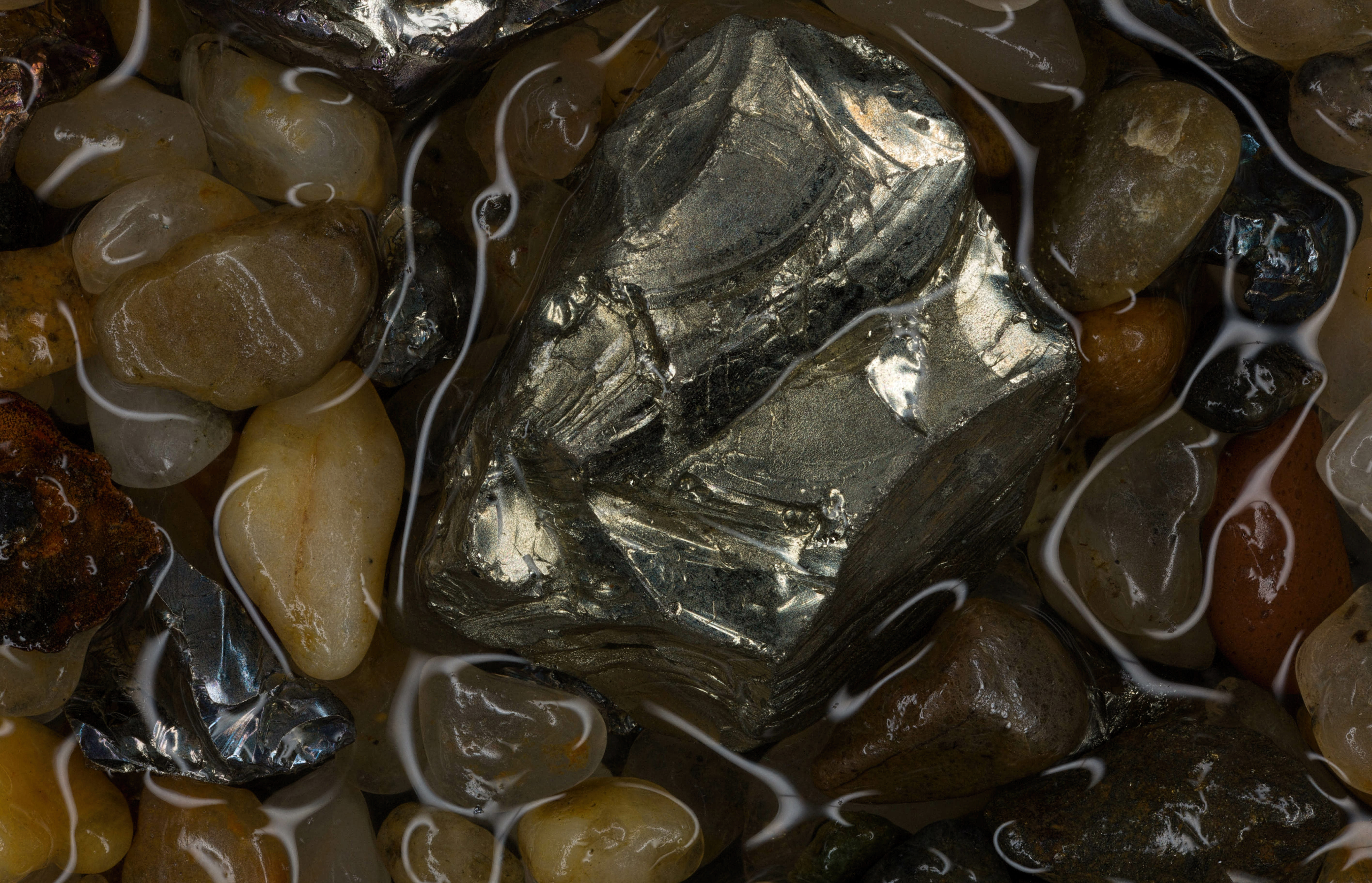
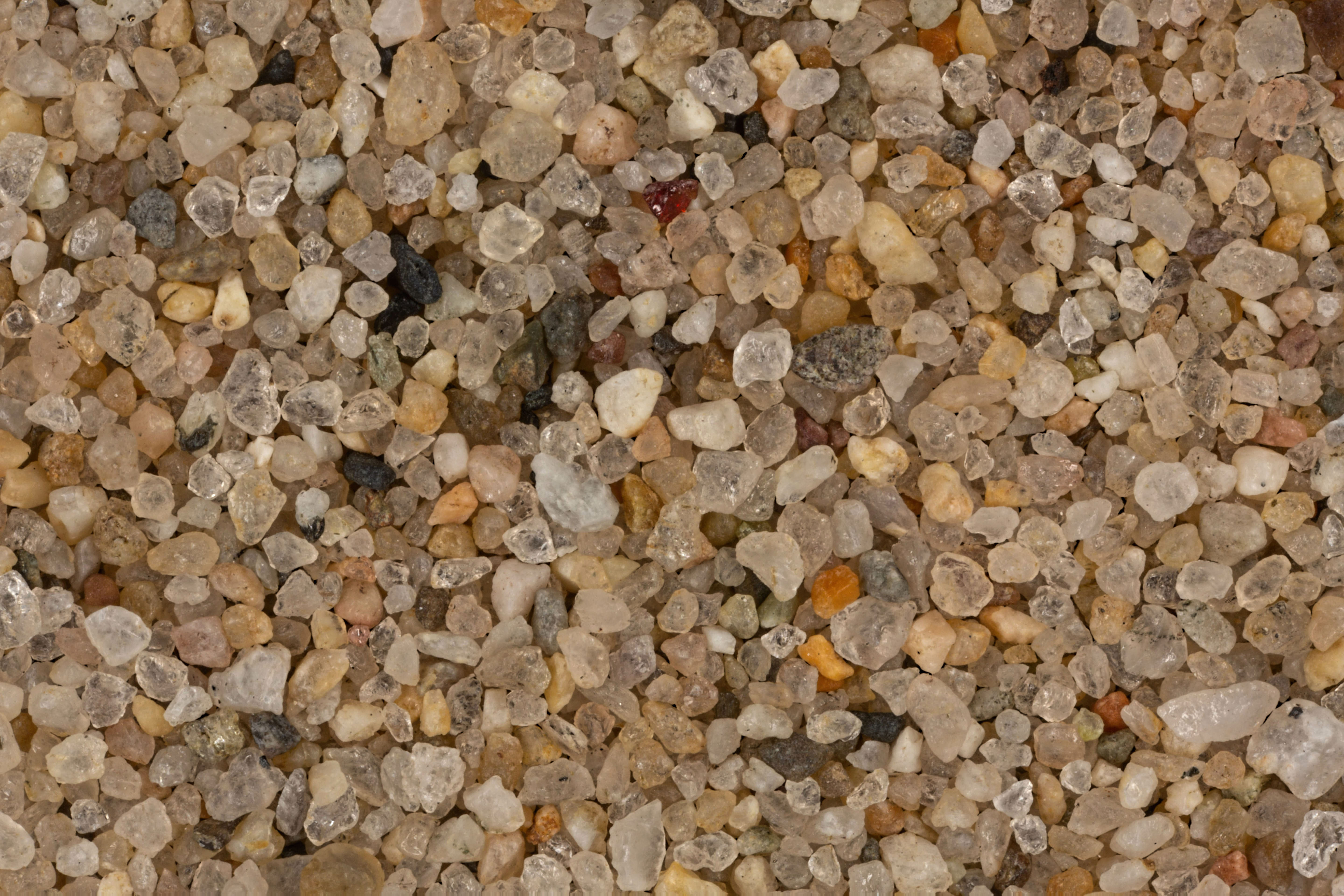
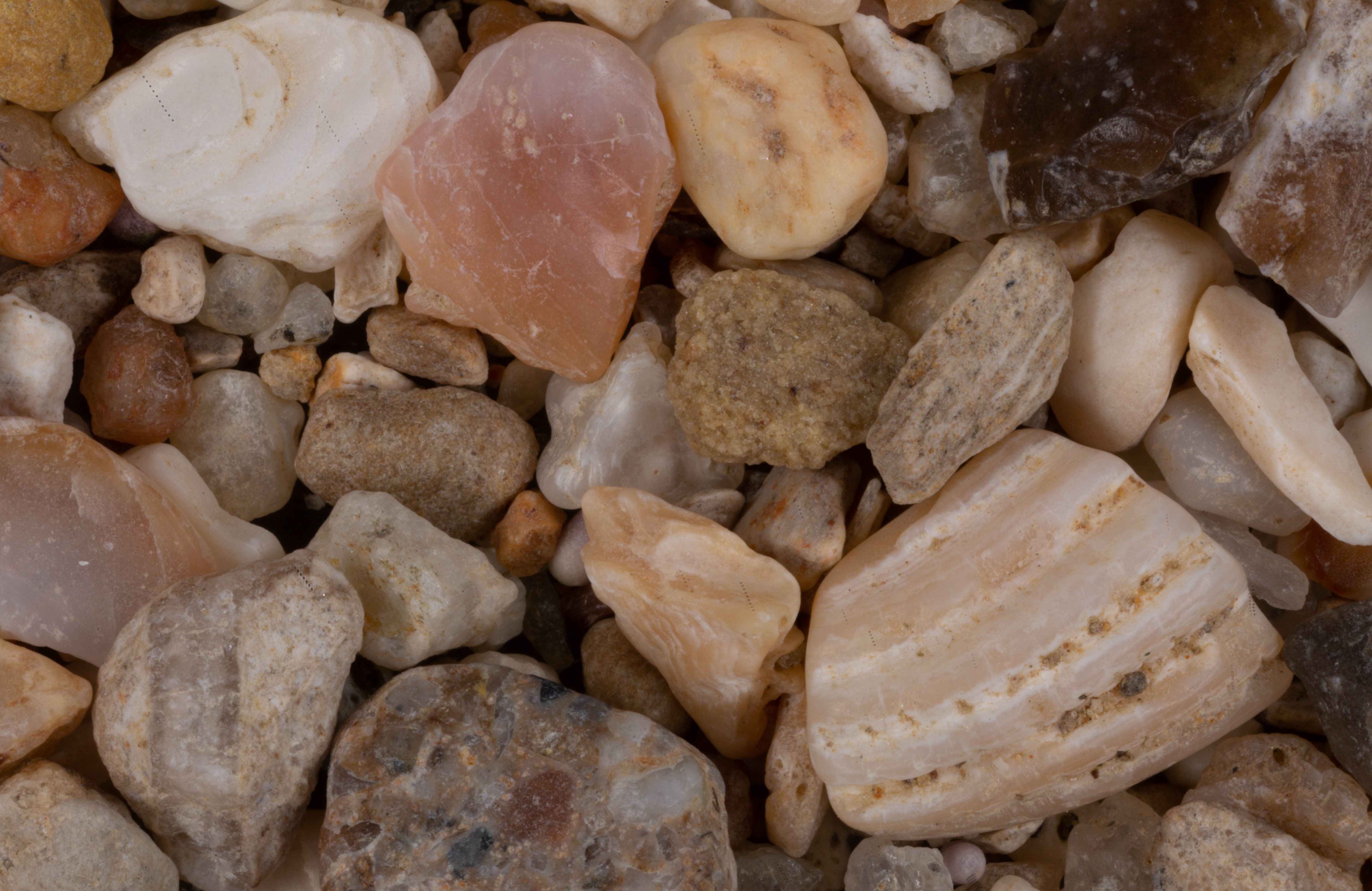
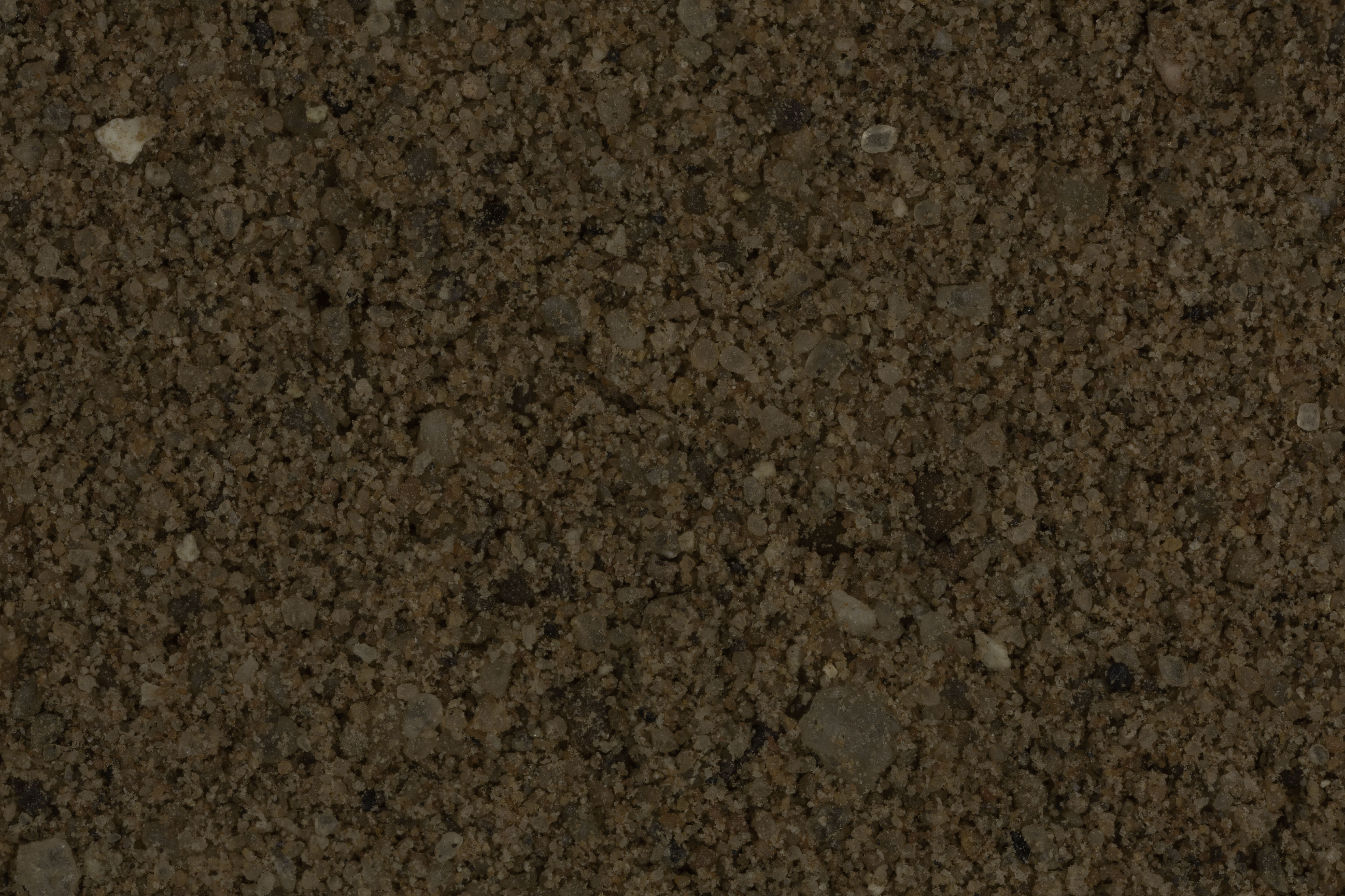
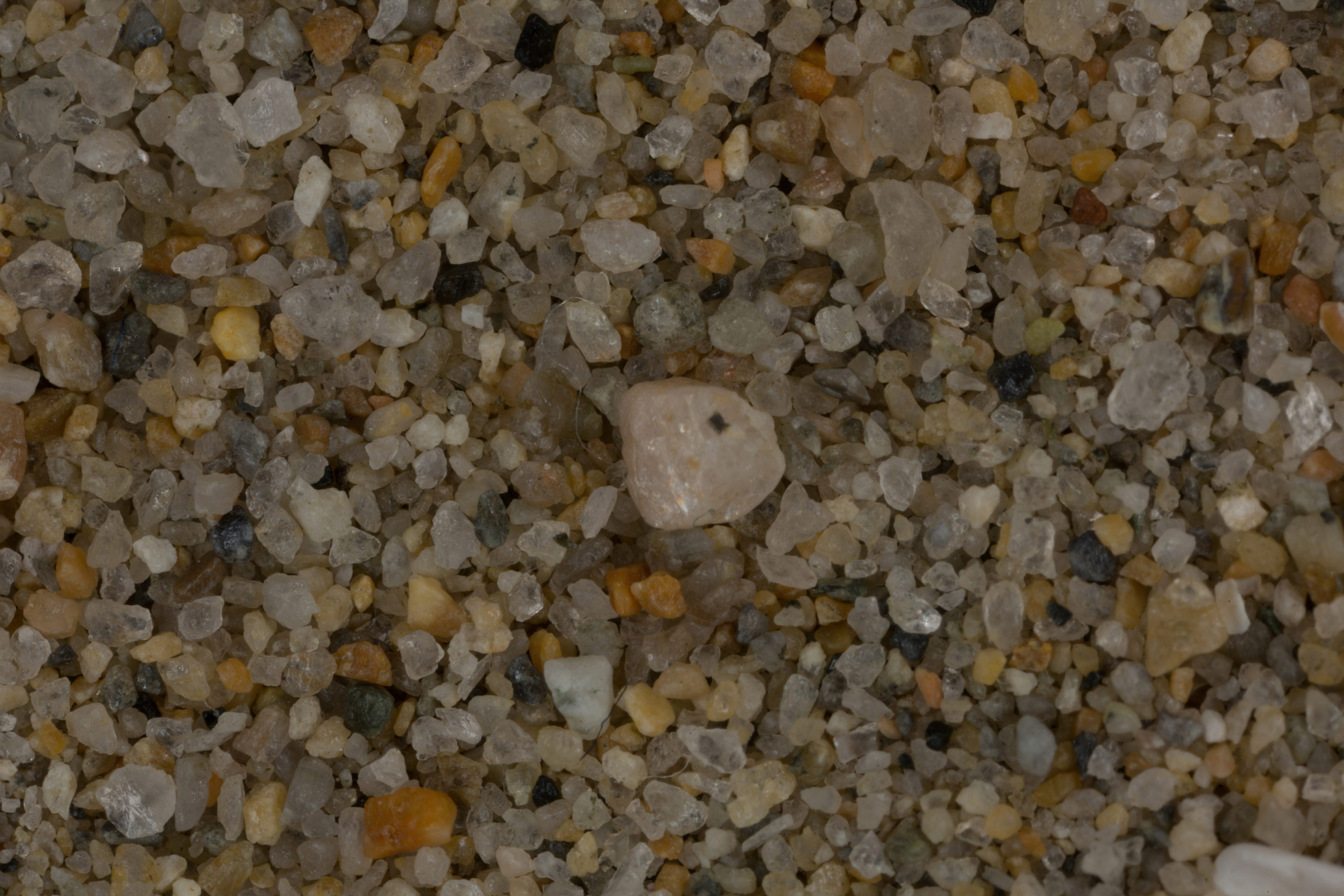
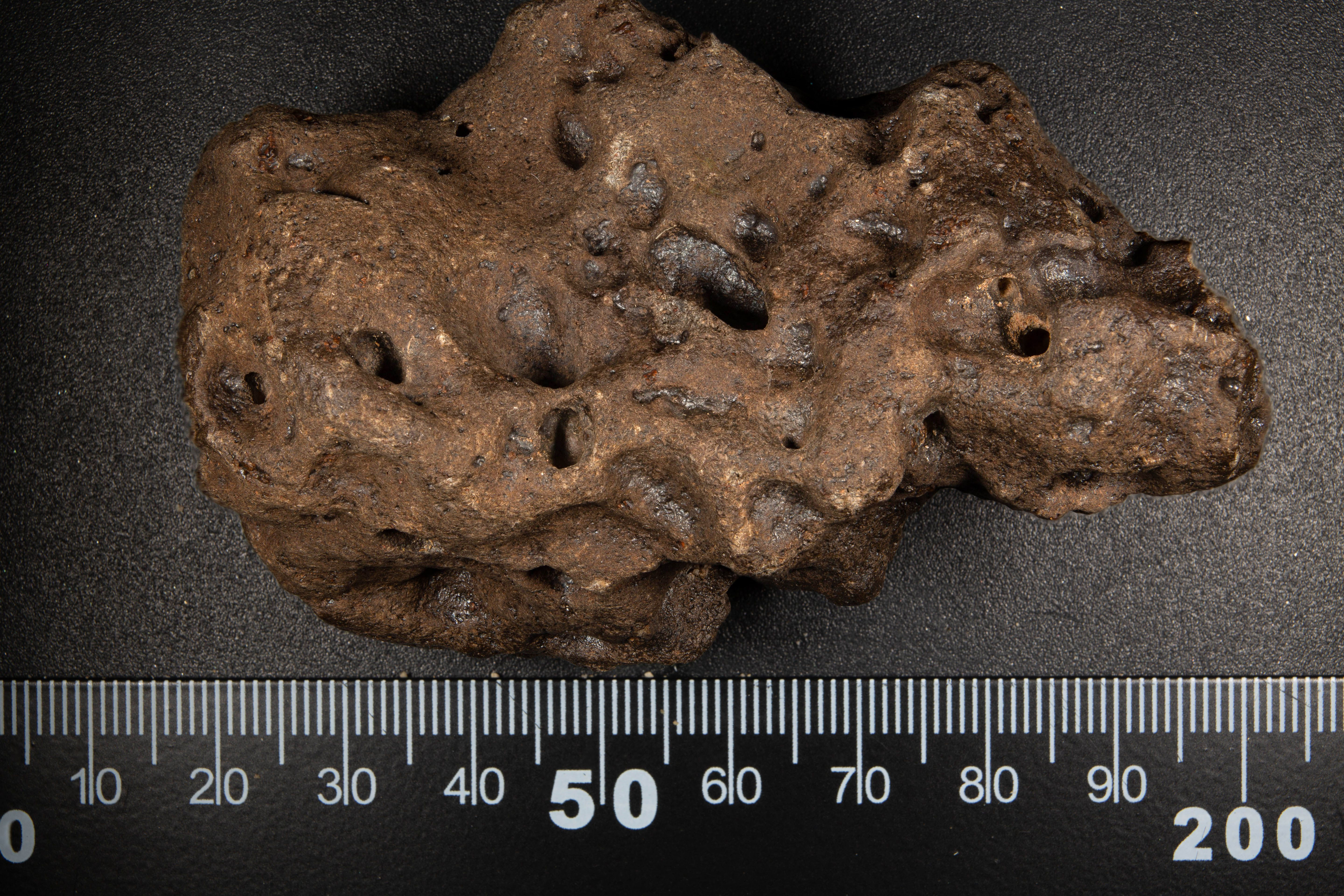
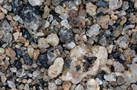
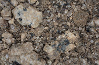
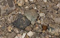
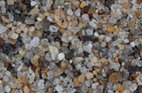
3X IMAGE
CLICK IMAGE FOR HIGH RES. |
|
| Mt. Shasta 41.41N, 122.14W |
 |
|
| Storries 39.90N, 121.32W |
 |
|
| Navarro 39.15N, 123.54W |
 |
|
| Lake Tahoe (2 Samples) Approximately 39.00N, 120.00W |
 |
|
| Folsom Lake State Recreational Area (2 Samples) 38.73N, 121.14W |
 |
|
| Sacramento River (2 Samples) 38.59N, 121.49W |
 |
|
| Bodega Bay 38.28N, 123.01W |
 |
|
| Point Reyes National Seashore (3 Samples) 38.07N, 122.88W |
 |
|
| Stinson Beach (2 Samples) 37.90N, 122.64W |
 |
|
| Sather Gate, U. C. Berkley 37.87N, 122.26W |
 |
|
| Tennessee Valley Beach 37.86N, 122.53W |
 |
|
| Muir Beach 37.85N, 122.58W |
 |
|
| Yosemite National Park, 37.85N, 119.55W |
 |
|
| Golden Gate Bridge 37.82N, 122.48W |
 |
|
| Alameda 37.76N, 122.27W |
 |
|
| San Francisco 37.72N, 122.50W |
 |
|
| Modesto 37.66N, 120.99W |
 |
|
| Pacifica (2 Samples) 37.61N, 122.50W |
 |
|
| Montara Beach, Montara 37.55N, 122.51W |
 |
|
| Half Moon Bay 37.46N, 122.44W |
 |
|
| Bear Creek, Merced 37.30N, 120.42W |
 |
|
| Boomeria, Bonny Boon 37.04N, 122.14W |
 |
|
| Moss Landing 36.80N, 121.79W |
 |
|
| Highway 190, Mile Marker 31 Approx. 36.80N, 118.20W |
 |
|
| Pacific Grove (2 Samples) 36.62N, 121.92W |
 |
|
| Monterey (3 Samples) 36.62N, 121.90W |
 |
|
| Orange Cove 36.62N, 119.32W |
 |
|
| Lone Pine 36.58N, 118.29W |
 |
|
| Carmel by the Sea (2 Samples) 36.56N, 121.92W |
 |
|
| Sequoia National Park 36.56N, 118.77W |
 |
|
| Point Lobos State Natural Preserve 36.52N, 121.94W |
 |
|
| Keeler 36.49N, 117.87W |
 |
|
| Panamint Springs, Death Valley 36.34N, 117.47W |
 |
|
| Badwater, Death Valley Nat. Park 36.25N, 116.83W |
 |
|
| Pfeiffer State Beach, Big Sur 36.23N, 121.82W |
 |
|
| Ivanpah Solar Generation Field 35.57N, 115.47W |
 |
|
| Nipton 35.47N, 115.27W |
 |
|
| Highway 164 Approximately 35.47N, 114.92W |
 |
|
| Moro Bay 35.37N, 120.87W |
 |
|
| Red Rock Canyon 35.37N, 117.99W |
 |
|
| Pismo Beach (2 Samples) 35.15N, 120.65W |
 |
|
| Temecula 33.50N, 117.12W |
 |
|
| Baker (2 Samples) 35.28N, 116.07W |
 |
|
| Los Osos (2 Samples) 35.26N, 120.86W |
 |
|
| Shell Beach, Pismo Beach 35.15N, 120.65W |
 |
|
| Near Kelso 35.01N, 115.65W |
 |
|
| Boron 35.00N, 117.65W |
 |
|
| Edwards Air Force Base 34.91N, 117.88W |
 |
|
| Mojave Desert Approx. 34.88N, 115.72W |
 |
|
| Hope Ranch Beach, Santa Barbara 34.42N, 119.70W |
 |
|
| Carpinteria 34.40N, 119.52W |
 |
|
| Ventura Beach 34.28N, 119.23W |
 |
|
|
 |
|
| Mandalay Beach, Oxnard (2 Samples) 34.19N, 119.18W |
 |
|
| Gene Autry Museum of the West "Gold" Panning Exhibit 34.18N, 118.33W |
 |
|
| Thornhill Broome Beach Sand Dune (4 SAMPLES) 34.09N, 118.96W |
 |
|
| Santa Monica 34.02N, 118.48W |
 |
|
| Paradise Cove, Malibu (2 Samples) 34.02N, 118.79W |
 |
|
| Santa Cruz Island (3 Samples) 34.02N, 119.77W |
 |
|
| Venice Beach 33.99N, 118.46W |
 |
|
| Playa del Rey, Los Angeles 33.95N, 118.45W |
 |
|
| Santiago Creek, Irvine Regional Park 33.78N, 117.70W |
 |
|
| White Point Park, San Pedro 33.74N, 118.24W |
 |
|
| La Quinta 33.67N, 116.30W |
 |
|
| California/Arizona I-10 Boundary 33.61N, 114.60W |
 |
|
| Balboa Island, Newport Beach, 33.60, 117.89W |
 |
|
| Salton Sea (2 Samples) 33.50N, 115.90W |
 |
|
| Temecula 33.50N, 117.12W |
|
|
| Murietta Creek, Rancho 33.47N, 117.14W |
 |
|
| Moonstone Beach, Cambria 33.39N, 118.37W |
 |
|
| Santa Catalina Island 33.38N, 118.42W |
 |
|
| Oceanside 33.21N, 117.33W |
 |
|
| Tamarack Beach, Carlsbad 33.15N, 117.35W |
 |
|
| Batiquitos Lagoon, Carlsbad 33.09N, 117.29W |
 |
|
| Solana Beach (2 Samples) 33.00N, 117.26W |
 |
|
| Crestwood Summit 32.93N, 116.60W |
 |
|
| Torrey Pines State Beach, San Diego (4 Samples) 32.90N, 117.24W |
 |
|
| La Jolla (2 Samples) 32.84N, 117.28W |
 |
|
| Lava Field, Interstate 8 Rest Stop, Pine Valley 32.83N, 116.53W |
 |
|
| San Clemente Island, Channel Islands 32.80N, 118.50W |
 |
|
| San Diego Area (6 Samples) 32.75N, 117.25W |
 |
|
Ocotillo (2 Samples) 32.74N, 116.00W |
 |
|
| Calexico 32.68N, 115.50W |
 |
|
| Jacumba (3 Samples) 32.62N, 116.19W |
 |
|
| Imperial Sand Dunes 31.85N, 114.95W |
 |
|
| |
|
|
| |
|
|
|